You are here: Home > Network List > TA - USArray Transportable Network (new EarthScope stations) Stations List
> Station J26L Joseph Creek, AK, USA > Earthquake Result Viewer
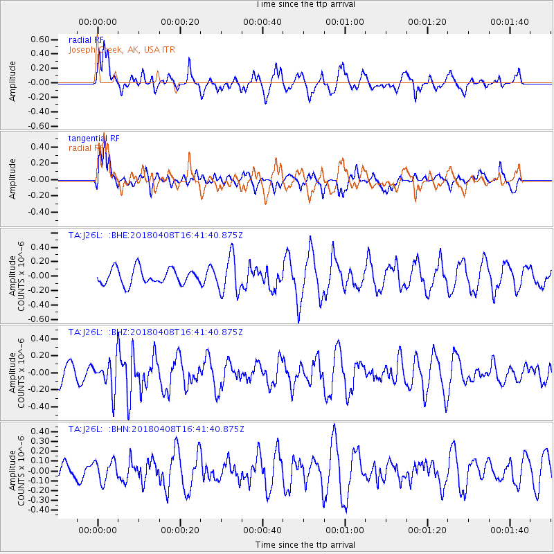
J26L Joseph Creek, AK, USA - Earthquake Result Viewer
*The percent match for this event was below the threshold and hence no stack was calculated.
| Earthquake location: |
Western Honshu, Japan |
| Earthquake latitude/longitude: |
35.3/132.5 |
| Earthquake time(UTC): |
2018/04/08 (098) 16:32:31 GMT |
| Earthquake Depth: |
9.4 km |
| Earthquake Magnitude: |
5.7 Mww |
| Earthquake Catalog/Contributor: |
NEIC PDE/us |
|
| Network: |
TA USArray Transportable Network (new EarthScope stations) |
| Station: |
J26L Joseph Creek, AK, USA |
| Lat/Lon: |
64.50 N/143.56 W |
| Elevation: |
1144 m |
|
| Distance: |
56.2 deg |
| Az: |
31.178 deg |
| Baz: |
281.821 deg |
| Ray Param: |
$rayparam |
*The percent match for this event was below the threshold and hence was not used in the summary stack. |
|
| Radial Match: |
53.423046 % |
| Radial Bump: |
400 |
| Transverse Match: |
66.731735 % |
| Transverse Bump: |
400 |
| SOD ConfigId: |
13570011 |
| Insert Time: |
2019-04-30 02:38:02.102 +0000 |
| GWidth: |
2.5 |
| Max Bumps: |
400 |
| Tol: |
0.001 |
|
Signal To Noise
| Channel | StoN | STA | LTA |
| TA:J26L: :BHZ:20180408T16:41:40.875Z | 1.8232063 | 1.9219829E-7 | 1.0541774E-7 |
| TA:J26L: :BHN:20180408T16:41:40.875Z | 0.56429017 | 1.0614704E-7 | 1.8810721E-7 |
| TA:J26L: :BHE:20180408T16:41:40.875Z | 2.4004261 | 2.5936527E-7 | 1.08049676E-7 |
| Arrivals |
| Ps | |
| PpPs | |
| PsPs/PpSs | |


