You are here: Home > Network List > TA - USArray Transportable Network (new EarthScope stations) Stations List
> Station R32K Eaglecrest, AK, USA > Earthquake Result Viewer
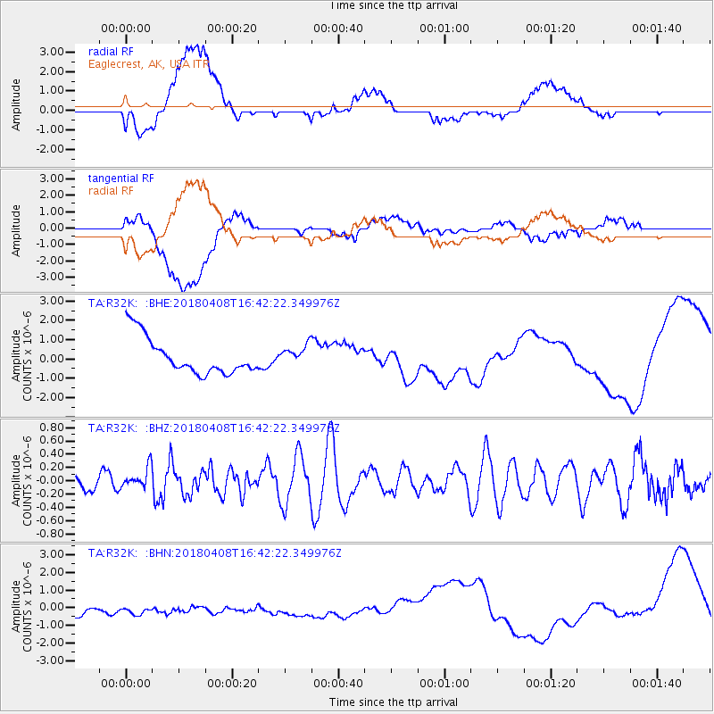
R32K Eaglecrest, AK, USA - Earthquake Result Viewer
*The percent match for this event was below the threshold and hence no stack was calculated.
| Earthquake location: |
Western Honshu, Japan |
| Earthquake latitude/longitude: |
35.3/132.5 |
| Earthquake time(UTC): |
2018/04/08 (098) 16:32:31 GMT |
| Earthquake Depth: |
9.4 km |
| Earthquake Magnitude: |
5.7 Mww |
| Earthquake Catalog/Contributor: |
NEIC PDE/us |
|
| Network: |
TA USArray Transportable Network (new EarthScope stations) |
| Station: |
R32K Eaglecrest, AK, USA |
| Lat/Lon: |
58.27 N/134.52 W |
| Elevation: |
386 m |
|
| Distance: |
62.2 deg |
| Az: |
36.607 deg |
| Baz: |
292.547 deg |
| Ray Param: |
$rayparam |
*The percent match for this event was below the threshold and hence was not used in the summary stack. |
|
| Radial Match: |
16.846928 % |
| Radial Bump: |
400 |
| Transverse Match: |
25.66682 % |
| Transverse Bump: |
400 |
| SOD ConfigId: |
13570011 |
| Insert Time: |
2019-04-30 02:38:18.643 +0000 |
| GWidth: |
2.5 |
| Max Bumps: |
400 |
| Tol: |
0.001 |
|
Signal To Noise
| Channel | StoN | STA | LTA |
| TA:R32K: :BHZ:20180408T16:42:22.349976Z | 0.9718816 | 1.5861198E-7 | 1.6320092E-7 |
| TA:R32K: :BHN:20180408T16:42:22.349976Z | 1.2998215 | 3.8524732E-7 | 2.9638477E-7 |
| TA:R32K: :BHE:20180408T16:42:22.349976Z | 0.5381291 | 5.118644E-7 | 9.511926E-7 |
| Arrivals |
| Ps | |
| PpPs | |
| PsPs/PpSs | |


