You are here: Home > Network List > TA - USArray Transportable Network (new EarthScope stations) Stations List
> Station O19A Miners Draw (BLM), Jensen, UT, USA > Earthquake Result Viewer
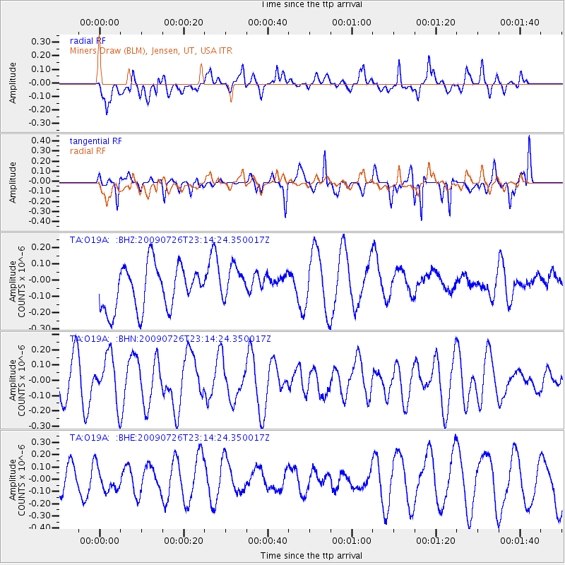
O19A Miners Draw (BLM), Jensen, UT, USA - Earthquake Result Viewer
*The percent match for this event was below the threshold and hence no stack was calculated.
| Earthquake location: |
Vanuatu Islands |
| Earthquake latitude/longitude: |
-17.8/168.1 |
| Earthquake time(UTC): |
2009/07/26 (207) 23:01:31 GMT |
| Earthquake Depth: |
25 km |
| Earthquake Magnitude: |
5.8 MB, 5.9 MW, 5.7 MW |
| Earthquake Catalog/Contributor: |
WHDF/NEIC |
|
| Network: |
TA USArray Transportable Network (new EarthScope stations) |
| Station: |
O19A Miners Draw (BLM), Jensen, UT, USA |
| Lat/Lon: |
40.30 N/109.12 W |
| Elevation: |
1649 m |
|
| Distance: |
96.0 deg |
| Az: |
49.72 deg |
| Baz: |
251.906 deg |
| Ray Param: |
$rayparam |
*The percent match for this event was below the threshold and hence was not used in the summary stack. |
|
| Radial Match: |
41.56486 % |
| Radial Bump: |
400 |
| Transverse Match: |
75.87112 % |
| Transverse Bump: |
300 |
| SOD ConfigId: |
2622 |
| Insert Time: |
2010-03-06 10:32:36.172 +0000 |
| GWidth: |
2.5 |
| Max Bumps: |
400 |
| Tol: |
0.001 |
|
Signal To Noise
| Channel | StoN | STA | LTA |
| TA:O19A: :BHN:20090726T23:14:24.350017Z | 1.2259116 | 1.5553422E-7 | 1.268723E-7 |
| TA:O19A: :BHE:20090726T23:14:24.350017Z | 1.0890775 | 9.035625E-8 | 8.296586E-8 |
| TA:O19A: :BHZ:20090726T23:14:24.350017Z | 0.77164793 | 1.0326178E-7 | 1.3381982E-7 |
| Arrivals |
| Ps | |
| PpPs | |
| PsPs/PpSs | |


