You are here: Home > Network List > TA - USArray Transportable Network (new EarthScope stations) Stations List
> Station O19A Miners Draw (BLM), Jensen, UT, USA > Earthquake Result Viewer
O19A Miners Draw (BLM), Jensen, UT, USA - Earthquake Result Viewer
*The percent match for this event was below the threshold and hence no stack was calculated.
| Earthquake location: |
Southeast Of Easter Island |
| Earthquake latitude/longitude: |
-36.0/-102.7 |
| Earthquake time(UTC): |
2009/07/08 (189) 19:23:37 GMT |
| Earthquake Depth: |
12 km |
| Earthquake Magnitude: |
5.5 MS, 5.4 MB, 6.0 MW, 5.9 MW |
| Earthquake Catalog/Contributor: |
WHDF/NEIC |
|
| Network: |
TA USArray Transportable Network (new EarthScope stations) |
| Station: |
O19A Miners Draw (BLM), Jensen, UT, USA |
| Lat/Lon: |
40.30 N/109.12 W |
| Elevation: |
1649 m |
|
| Distance: |
76.2 deg |
| Az: |
354.933 deg |
| Baz: |
174.627 deg |
| Ray Param: |
$rayparam |
*The percent match for this event was below the threshold and hence was not used in the summary stack. |
|
| Radial Match: |
63.273556 % |
| Radial Bump: |
400 |
| Transverse Match: |
54.554356 % |
| Transverse Bump: |
400 |
| SOD ConfigId: |
2648 |
| Insert Time: |
2010-03-06 10:33:50.564 +0000 |
| GWidth: |
2.5 |
| Max Bumps: |
400 |
| Tol: |
0.001 |
|
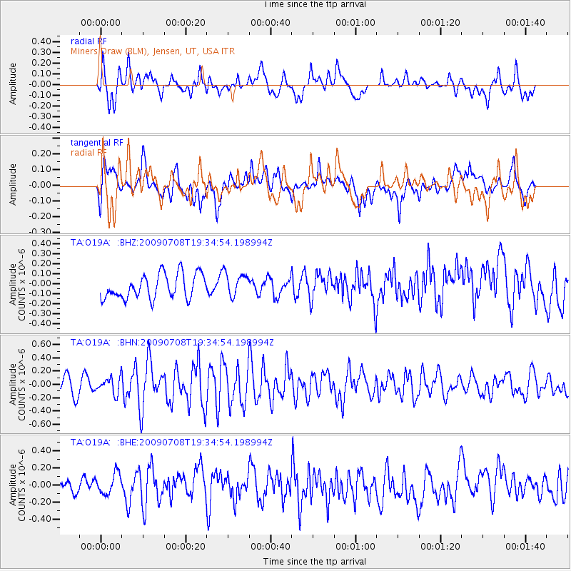
Signal To Noise
| Channel | StoN | STA | LTA |
| TA:O19A: :BHN:20090708T19:34:54.198994Z | 0.9478813 | 1.2459923E-7 | 1.3145024E-7 |
| TA:O19A: :BHE:20090708T19:34:54.198994Z | 1.2350984 | 1.1998407E-7 | 9.714535E-8 |
| TA:O19A: :BHZ:20090708T19:34:54.198994Z | 0.9366234 | 1.13474876E-7 | 1.2115315E-7 |
| Arrivals |
| Ps | |
| PpPs | |
| PsPs/PpSs | |


