You are here: Home > Network List > TA - USArray Transportable Network (new EarthScope stations) Stations List
> Station M53A WI Miller and Sons, Farmdale, OH, USA > Earthquake Result Viewer
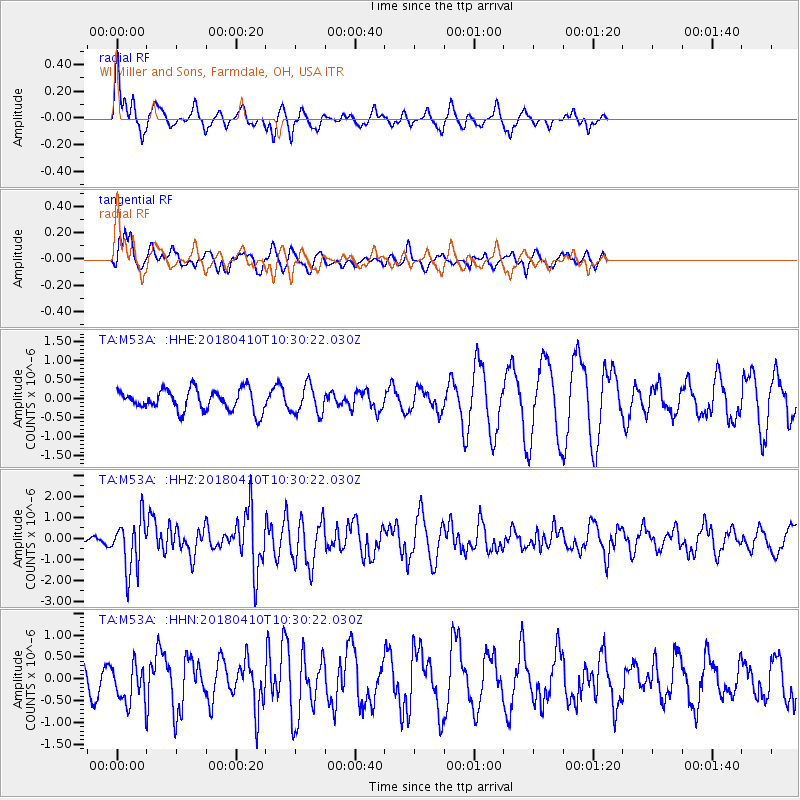
M53A WI Miller and Sons, Farmdale, OH, USA - Earthquake Result Viewer
*The percent match for this event was below the threshold and hence no stack was calculated.
| Earthquake location: |
Near Coast Of Central Chile |
| Earthquake latitude/longitude: |
-31.0/-71.6 |
| Earthquake time(UTC): |
2018/04/10 (100) 10:19:34 GMT |
| Earthquake Depth: |
76 km |
| Earthquake Magnitude: |
6.2 Mww |
| Earthquake Catalog/Contributor: |
NEIC PDE/us |
|
| Network: |
TA USArray Transportable Network (new EarthScope stations) |
| Station: |
M53A WI Miller and Sons, Farmdale, OH, USA |
| Lat/Lon: |
41.44 N/80.68 W |
| Elevation: |
334 m |
|
| Distance: |
72.6 deg |
| Az: |
352.825 deg |
| Baz: |
171.798 deg |
| Ray Param: |
$rayparam |
*The percent match for this event was below the threshold and hence was not used in the summary stack. |
|
| Radial Match: |
66.058655 % |
| Radial Bump: |
372 |
| Transverse Match: |
66.4542 % |
| Transverse Bump: |
382 |
| SOD ConfigId: |
13570011 |
| Insert Time: |
2019-04-30 02:50:38.670 +0000 |
| GWidth: |
2.5 |
| Max Bumps: |
400 |
| Tol: |
0.001 |
|
Signal To Noise
| Channel | StoN | STA | LTA |
| TA:M53A: :HHZ:20180410T10:30:22.030Z | 1.4830589 | 1.2431731E-6 | 8.3824926E-7 |
| TA:M53A: :HHN:20180410T10:30:22.030Z | 0.6218433 | 4.3320145E-7 | 6.966409E-7 |
| TA:M53A: :HHE:20180410T10:30:22.030Z | 1.3501097 | 3.73287E-7 | 2.7648642E-7 |
| Arrivals |
| Ps | |
| PpPs | |
| PsPs/PpSs | |


