You are here: Home > Network List > TA - USArray Transportable Network (new EarthScope stations) Stations List
> Station O19A Miners Draw (BLM), Jensen, UT, USA > Earthquake Result Viewer
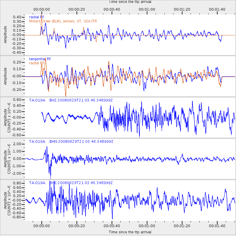
O19A Miners Draw (BLM), Jensen, UT, USA - Earthquake Result Viewer
*The percent match for this event was below the threshold and hence no stack was calculated.
| Earthquake location: |
Primor'ye, Russia |
| Earthquake latitude/longitude: |
45.2/137.4 |
| Earthquake time(UTC): |
2008/06/29 (181) 20:53:01 GMT |
| Earthquake Depth: |
287 km |
| Earthquake Magnitude: |
5.6 MB, 6.0 MW, 5.9 MW |
| Earthquake Catalog/Contributor: |
WHDF/NEIC |
|
| Network: |
TA USArray Transportable Network (new EarthScope stations) |
| Station: |
O19A Miners Draw (BLM), Jensen, UT, USA |
| Lat/Lon: |
40.30 N/109.12 W |
| Elevation: |
1649 m |
|
| Distance: |
76.1 deg |
| Az: |
46.281 deg |
| Baz: |
318.043 deg |
| Ray Param: |
$rayparam |
*The percent match for this event was below the threshold and hence was not used in the summary stack. |
|
| Radial Match: |
67.47598 % |
| Radial Bump: |
400 |
| Transverse Match: |
66.56113 % |
| Transverse Bump: |
400 |
| SOD ConfigId: |
2504 |
| Insert Time: |
2010-03-06 10:34:36.488 +0000 |
| GWidth: |
2.5 |
| Max Bumps: |
400 |
| Tol: |
0.001 |
|
Signal To Noise
| Channel | StoN | STA | LTA |
| TA:O19A: :BHN:20080629T21:03:46.348999Z | 6.710398 | 7.2222116E-7 | 1.0762717E-7 |
| TA:O19A: :BHE:20080629T21:03:46.348999Z | 2.7961547 | 2.6061187E-7 | 9.320367E-8 |
| TA:O19A: :BHZ:20080629T21:03:46.348999Z | 1.8001155 | 1.3862753E-7 | 7.701035E-8 |
| Arrivals |
| Ps | |
| PpPs | |
| PsPs/PpSs | |


