You are here: Home > Network List > TA - USArray Transportable Network (new EarthScope stations) Stations List
> Station F20K Avaraart Lake, AK, USA > Earthquake Result Viewer
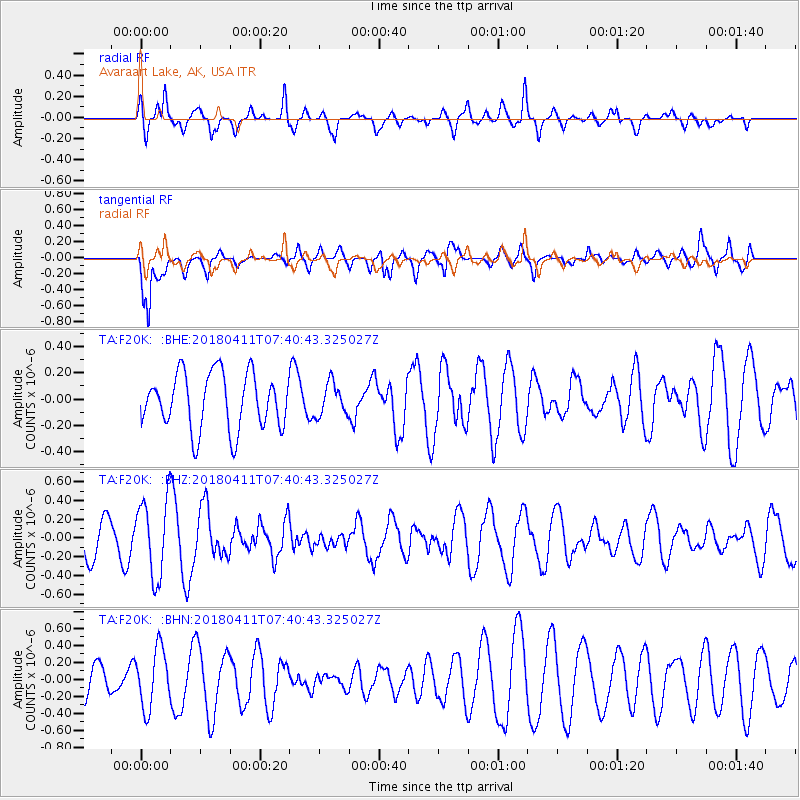
F20K Avaraart Lake, AK, USA - Earthquake Result Viewer
*The percent match for this event was below the threshold and hence no stack was calculated.
| Earthquake location: |
Near Coast Of Oaxaca, Mexico |
| Earthquake latitude/longitude: |
15.8/-94.8 |
| Earthquake time(UTC): |
2018/04/11 (101) 07:30:42 GMT |
| Earthquake Depth: |
41 km |
| Earthquake Magnitude: |
5.5 Mww |
| Earthquake Catalog/Contributor: |
NEIC PDE/us |
|
| Network: |
TA USArray Transportable Network (new EarthScope stations) |
| Station: |
F20K Avaraart Lake, AK, USA |
| Lat/Lon: |
67.05 N/155.73 W |
| Elevation: |
136 m |
|
| Distance: |
64.4 deg |
| Az: |
337.657 deg |
| Baz: |
111.045 deg |
| Ray Param: |
$rayparam |
*The percent match for this event was below the threshold and hence was not used in the summary stack. |
|
| Radial Match: |
58.636417 % |
| Radial Bump: |
367 |
| Transverse Match: |
72.52512 % |
| Transverse Bump: |
400 |
| SOD ConfigId: |
13570011 |
| Insert Time: |
2019-04-30 02:56:35.925 +0000 |
| GWidth: |
2.5 |
| Max Bumps: |
400 |
| Tol: |
0.001 |
|
Signal To Noise
| Channel | StoN | STA | LTA |
| TA:F20K: :BHZ:20180411T07:40:43.325027Z | 1.4486091 | 4.1918284E-7 | 2.8936918E-7 |
| TA:F20K: :BHN:20180411T07:40:43.325027Z | 1.4160552 | 3.4653795E-7 | 2.4472067E-7 |
| TA:F20K: :BHE:20180411T07:40:43.325027Z | 0.5750167 | 1.2206651E-7 | 2.1228341E-7 |
| Arrivals |
| Ps | |
| PpPs | |
| PsPs/PpSs | |


