You are here: Home > Network List > TA - USArray Transportable Network (new EarthScope stations) Stations List
> Station O19A Miners Draw (BLM), Jensen, UT, USA > Earthquake Result Viewer
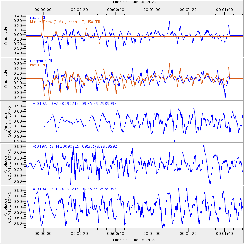
O19A Miners Draw (BLM), Jensen, UT, USA - Earthquake Result Viewer
*The percent match for this event was below the threshold and hence no stack was calculated.
| Earthquake location: |
Near East Coast Of Honshu, Japan |
| Earthquake latitude/longitude: |
40.2/142.2 |
| Earthquake time(UTC): |
2009/02/15 (046) 09:24:31 GMT |
| Earthquake Depth: |
33 km |
| Earthquake Magnitude: |
6.1 MB, 5.5 MS, 5.7 MW, 5.7 MW |
| Earthquake Catalog/Contributor: |
WHDF/NEIC |
|
| Network: |
TA USArray Transportable Network (new EarthScope stations) |
| Station: |
O19A Miners Draw (BLM), Jensen, UT, USA |
| Lat/Lon: |
40.30 N/109.12 W |
| Elevation: |
1649 m |
|
| Distance: |
76.9 deg |
| Az: |
48.091 deg |
| Baz: |
311.854 deg |
| Ray Param: |
$rayparam |
*The percent match for this event was below the threshold and hence was not used in the summary stack. |
|
| Radial Match: |
55.57916 % |
| Radial Bump: |
400 |
| Transverse Match: |
53.07222 % |
| Transverse Bump: |
400 |
| SOD ConfigId: |
2658 |
| Insert Time: |
2010-03-06 10:35:23.662 +0000 |
| GWidth: |
2.5 |
| Max Bumps: |
400 |
| Tol: |
0.001 |
|
Signal To Noise
| Channel | StoN | STA | LTA |
| TA:O19A: :BHN:20090215T09:35:49.298999Z | 1.534584 | 2.8663212E-7 | 1.8678165E-7 |
| TA:O19A: :BHE:20090215T09:35:49.298999Z | 1.4896723 | 5.5847767E-7 | 3.7489968E-7 |
| TA:O19A: :BHZ:20090215T09:35:49.298999Z | 1.8314458 | 3.7097638E-7 | 2.0255929E-7 |
| Arrivals |
| Ps | |
| PpPs | |
| PsPs/PpSs | |


