You are here: Home > Network List > TA - USArray Transportable Network (new EarthScope stations) Stations List
> Station D25K Kavik River, AK, USA > Earthquake Result Viewer
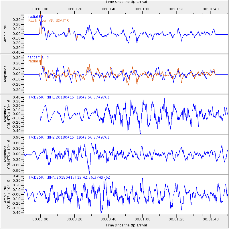
D25K Kavik River, AK, USA - Earthquake Result Viewer
*The percent match for this event was below the threshold and hence no stack was calculated.
| Earthquake location: |
Northern Molucca Sea |
| Earthquake latitude/longitude: |
1.4/126.9 |
| Earthquake time(UTC): |
2018/04/15 (105) 19:30:43 GMT |
| Earthquake Depth: |
36 km |
| Earthquake Magnitude: |
5.9 Mww |
| Earthquake Catalog/Contributor: |
NEIC PDE/us |
|
| Network: |
TA USArray Transportable Network (new EarthScope stations) |
| Station: |
D25K Kavik River, AK, USA |
| Lat/Lon: |
69.32 N/146.38 W |
| Elevation: |
770 m |
|
| Distance: |
87.6 deg |
| Az: |
20.79 deg |
| Baz: |
267.448 deg |
| Ray Param: |
$rayparam |
*The percent match for this event was below the threshold and hence was not used in the summary stack. |
|
| Radial Match: |
59.23447 % |
| Radial Bump: |
400 |
| Transverse Match: |
57.90539 % |
| Transverse Bump: |
400 |
| SOD ConfigId: |
13570011 |
| Insert Time: |
2019-04-30 03:03:59.431 +0000 |
| GWidth: |
2.5 |
| Max Bumps: |
400 |
| Tol: |
0.001 |
|
Signal To Noise
| Channel | StoN | STA | LTA |
| TA:D25K: :BHZ:20180415T19:42:56.374976Z | 2.8070292 | 2.2224629E-7 | 7.917491E-8 |
| TA:D25K: :BHN:20180415T19:42:56.374976Z | 0.7056817 | 7.9831096E-8 | 1.1312621E-7 |
| TA:D25K: :BHE:20180415T19:42:56.374976Z | 0.6521182 | 6.855454E-8 | 1.05125935E-7 |
| Arrivals |
| Ps | |
| PpPs | |
| PsPs/PpSs | |


