You are here: Home > Network List > TA - USArray Transportable Network (new EarthScope stations) Stations List
> Station G22K Bettles, AK, USA > Earthquake Result Viewer
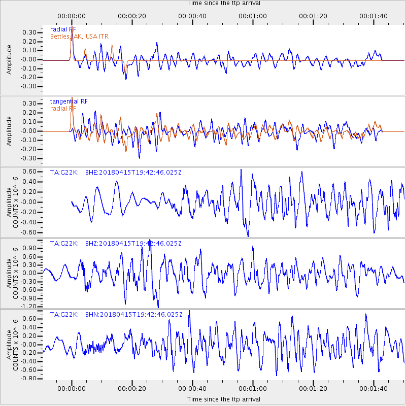
G22K Bettles, AK, USA - Earthquake Result Viewer
*The percent match for this event was below the threshold and hence no stack was calculated.
| Earthquake location: |
Northern Molucca Sea |
| Earthquake latitude/longitude: |
1.4/126.9 |
| Earthquake time(UTC): |
2018/04/15 (105) 19:30:43 GMT |
| Earthquake Depth: |
36 km |
| Earthquake Magnitude: |
5.9 Mww |
| Earthquake Catalog/Contributor: |
NEIC PDE/us |
|
| Network: |
TA USArray Transportable Network (new EarthScope stations) |
| Station: |
G22K Bettles, AK, USA |
| Lat/Lon: |
66.92 N/151.51 W |
| Elevation: |
205 m |
|
| Distance: |
85.5 deg |
| Az: |
23.032 deg |
| Baz: |
262.825 deg |
| Ray Param: |
$rayparam |
*The percent match for this event was below the threshold and hence was not used in the summary stack. |
|
| Radial Match: |
63.477886 % |
| Radial Bump: |
400 |
| Transverse Match: |
62.300915 % |
| Transverse Bump: |
400 |
| SOD ConfigId: |
13570011 |
| Insert Time: |
2019-04-30 03:04:11.113 +0000 |
| GWidth: |
2.5 |
| Max Bumps: |
400 |
| Tol: |
0.001 |
|
Signal To Noise
| Channel | StoN | STA | LTA |
| TA:G22K: :BHZ:20180415T19:42:46.025Z | 2.5166788 | 2.5768185E-7 | 1.0238965E-7 |
| TA:G22K: :BHN:20180415T19:42:46.025Z | 1.1842637 | 1.9394341E-7 | 1.6376708E-7 |
| TA:G22K: :BHE:20180415T19:42:46.025Z | 0.58697593 | 1.029826E-7 | 1.7544603E-7 |
| Arrivals |
| Ps | |
| PpPs | |
| PsPs/PpSs | |


