You are here: Home > Network List > TA - USArray Transportable Network (new EarthScope stations) Stations List
> Station H16K Elim, AK, USA > Earthquake Result Viewer
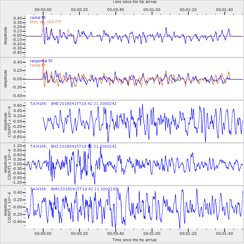
H16K Elim, AK, USA - Earthquake Result Viewer
*The percent match for this event was below the threshold and hence no stack was calculated.
| Earthquake location: |
Northern Molucca Sea |
| Earthquake latitude/longitude: |
1.4/126.9 |
| Earthquake time(UTC): |
2018/04/15 (105) 19:30:43 GMT |
| Earthquake Depth: |
36 km |
| Earthquake Magnitude: |
5.9 Mww |
| Earthquake Catalog/Contributor: |
NEIC PDE/us |
|
| Network: |
TA USArray Transportable Network (new EarthScope stations) |
| Station: |
H16K Elim, AK, USA |
| Lat/Lon: |
64.64 N/162.24 W |
| Elevation: |
216 m |
|
| Distance: |
80.7 deg |
| Az: |
24.358 deg |
| Baz: |
253.203 deg |
| Ray Param: |
$rayparam |
*The percent match for this event was below the threshold and hence was not used in the summary stack. |
|
| Radial Match: |
68.65679 % |
| Radial Bump: |
400 |
| Transverse Match: |
63.257717 % |
| Transverse Bump: |
400 |
| SOD ConfigId: |
13570011 |
| Insert Time: |
2019-04-30 03:04:14.596 +0000 |
| GWidth: |
2.5 |
| Max Bumps: |
400 |
| Tol: |
0.001 |
|
Signal To Noise
| Channel | StoN | STA | LTA |
| TA:H16K: :BHZ:20180415T19:42:21.300024Z | 1.7417364 | 3.1413444E-7 | 1.8035705E-7 |
| TA:H16K: :BHN:20180415T19:42:21.300024Z | 0.9946491 | 1.9383037E-7 | 1.9487312E-7 |
| TA:H16K: :BHE:20180415T19:42:21.300024Z | 1.5057697 | 3.0898838E-7 | 2.0520295E-7 |
| Arrivals |
| Ps | |
| PpPs | |
| PsPs/PpSs | |


