You are here: Home > Network List > TJ - Tajikistan National Seismic Network Stations List
> Station GARM Garm, Tajikistan > Earthquake Result Viewer
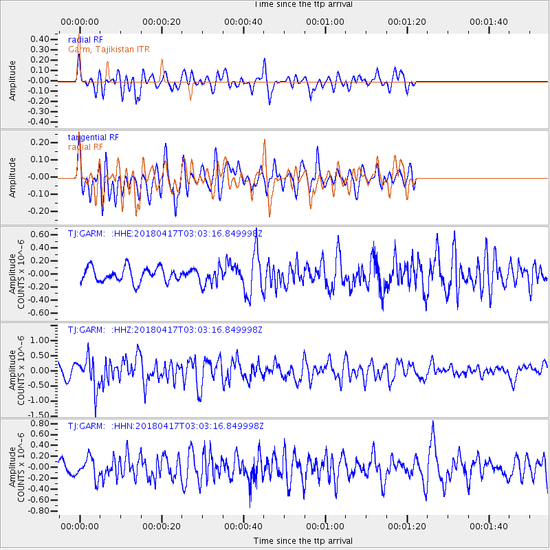
GARM Garm, Tajikistan - Earthquake Result Viewer
*The percent match for this event was below the threshold and hence no stack was calculated.
| Earthquake location: |
Irian Jaya Region, Indonesia |
| Earthquake latitude/longitude: |
-3.5/131.3 |
| Earthquake time(UTC): |
2018/04/17 (107) 02:52:35 GMT |
| Earthquake Depth: |
10 km |
| Earthquake Magnitude: |
5.5 Mww |
| Earthquake Catalog/Contributor: |
NEIC PDE/us |
|
| Network: |
TJ Tajikistan National Seismic Network |
| Station: |
GARM Garm, Tajikistan |
| Lat/Lon: |
39.00 N/70.32 E |
| Elevation: |
1305 m |
|
| Distance: |
70.2 deg |
| Az: |
313.594 deg |
| Baz: |
111.918 deg |
| Ray Param: |
$rayparam |
*The percent match for this event was below the threshold and hence was not used in the summary stack. |
|
| Radial Match: |
58.472282 % |
| Radial Bump: |
400 |
| Transverse Match: |
57.280476 % |
| Transverse Bump: |
400 |
| SOD ConfigId: |
13570011 |
| Insert Time: |
2019-04-30 03:07:47.600 +0000 |
| GWidth: |
2.5 |
| Max Bumps: |
400 |
| Tol: |
0.001 |
|
Signal To Noise
| Channel | StoN | STA | LTA |
| TJ:GARM: :HHZ:20180417T03:03:16.849998Z | 2.9236913 | 5.345922E-7 | 1.8284837E-7 |
| TJ:GARM: :HHN:20180417T03:03:16.849998Z | 1.6071117 | 1.9533788E-7 | 1.2154592E-7 |
| TJ:GARM: :HHE:20180417T03:03:16.849998Z | 1.2778729 | 1.4165978E-7 | 1.1085592E-7 |
| Arrivals |
| Ps | |
| PpPs | |
| PsPs/PpSs | |


