You are here: Home > Network List > TA - USArray Transportable Network (new EarthScope stations) Stations List
> Station 327A Balmorhea Ranch, Pecos, TX, USA > Earthquake Result Viewer
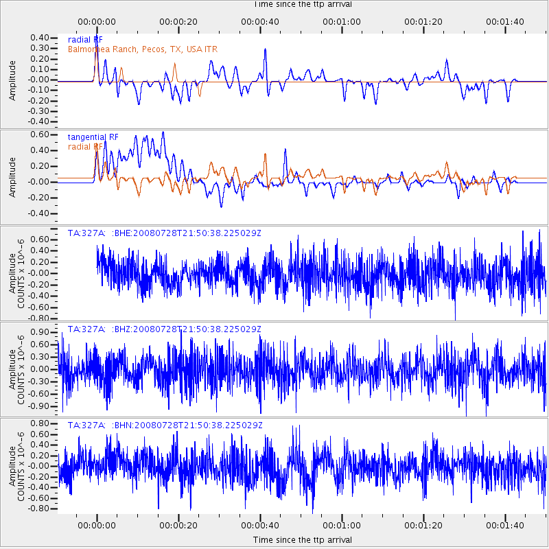
327A Balmorhea Ranch, Pecos, TX, USA - Earthquake Result Viewer
*The percent match for this event was below the threshold and hence no stack was calculated.
| Earthquake location: |
Solomon Islands |
| Earthquake latitude/longitude: |
-10.6/163.2 |
| Earthquake time(UTC): |
2008/07/28 (210) 21:37:32 GMT |
| Earthquake Depth: |
10 km |
| Earthquake Magnitude: |
5.7 MB, 6.1 MS, 5.9 MW |
| Earthquake Catalog/Contributor: |
WHDF/NEIC |
|
| Network: |
TA USArray Transportable Network (new EarthScope stations) |
| Station: |
327A Balmorhea Ranch, Pecos, TX, USA |
| Lat/Lon: |
31.37 N/103.49 W |
| Elevation: |
784 m |
|
| Distance: |
98.3 deg |
| Az: |
59.643 deg |
| Baz: |
262.644 deg |
| Ray Param: |
$rayparam |
*The percent match for this event was below the threshold and hence was not used in the summary stack. |
|
| Radial Match: |
57.585476 % |
| Radial Bump: |
400 |
| Transverse Match: |
62.90451 % |
| Transverse Bump: |
400 |
| SOD ConfigId: |
2658 |
| Insert Time: |
2010-03-06 10:37:30.931 +0000 |
| GWidth: |
2.5 |
| Max Bumps: |
400 |
| Tol: |
0.001 |
|
Signal To Noise
| Channel | StoN | STA | LTA |
| TA:327A: :BHZ:20080728T21:50:38.225029Z | 1.1226486 | 3.5128596E-7 | 3.129082E-7 |
| TA:327A: :BHN:20080728T21:50:38.225029Z | 1.3904403 | 2.7058158E-7 | 1.9460137E-7 |
| TA:327A: :BHE:20080728T21:50:38.225029Z | 0.97912866 | 1.9919742E-7 | 2.0344355E-7 |
| Arrivals |
| Ps | |
| PpPs | |
| PsPs/PpSs | |


