You are here: Home > Network List > TA - USArray Transportable Network (new EarthScope stations) Stations List
> Station D23K Nanushuk River, AK USA > Earthquake Result Viewer
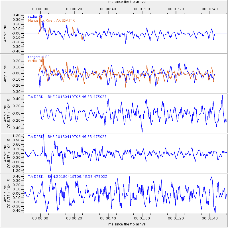
D23K Nanushuk River, AK USA - Earthquake Result Viewer
*The percent match for this event was below the threshold and hence no stack was calculated.
| Earthquake location: |
Southern Iran |
| Earthquake latitude/longitude: |
28.4/51.6 |
| Earthquake time(UTC): |
2018/04/19 (109) 06:34:47 GMT |
| Earthquake Depth: |
10 km |
| Earthquake Magnitude: |
5.5 Mww |
| Earthquake Catalog/Contributor: |
NEIC PDE/us |
|
| Network: |
TA USArray Transportable Network (new EarthScope stations) |
| Station: |
D23K Nanushuk River, AK USA |
| Lat/Lon: |
68.97 N/150.68 W |
| Elevation: |
406 m |
|
| Distance: |
81.6 deg |
| Az: |
7.96 deg |
| Baz: |
340.242 deg |
| Ray Param: |
$rayparam |
*The percent match for this event was below the threshold and hence was not used in the summary stack. |
|
| Radial Match: |
66.04134 % |
| Radial Bump: |
400 |
| Transverse Match: |
59.467636 % |
| Transverse Bump: |
400 |
| SOD ConfigId: |
13570011 |
| Insert Time: |
2019-04-30 03:12:26.901 +0000 |
| GWidth: |
2.5 |
| Max Bumps: |
400 |
| Tol: |
0.001 |
|
Signal To Noise
| Channel | StoN | STA | LTA |
| TA:D23K: :BHZ:20180419T06:46:33.47502Z | 2.2874787 | 4.6574277E-7 | 2.036053E-7 |
| TA:D23K: :BHN:20180419T06:46:33.47502Z | 1.7099235 | 2.0562307E-7 | 1.2025279E-7 |
| TA:D23K: :BHE:20180419T06:46:33.47502Z | 0.60938793 | 7.854844E-8 | 1.2889726E-7 |
| Arrivals |
| Ps | |
| PpPs | |
| PsPs/PpSs | |


