You are here: Home > Network List > TA - USArray Transportable Network (new EarthScope stations) Stations List
> Station G21K Allakaket, AK, USA > Earthquake Result Viewer
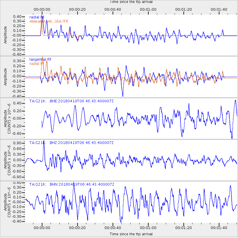
G21K Allakaket, AK, USA - Earthquake Result Viewer
*The percent match for this event was below the threshold and hence no stack was calculated.
| Earthquake location: |
Southern Iran |
| Earthquake latitude/longitude: |
28.4/51.6 |
| Earthquake time(UTC): |
2018/04/19 (109) 06:34:47 GMT |
| Earthquake Depth: |
10 km |
| Earthquake Magnitude: |
5.5 Mww |
| Earthquake Catalog/Contributor: |
NEIC PDE/us |
|
| Network: |
TA USArray Transportable Network (new EarthScope stations) |
| Station: |
G21K Allakaket, AK, USA |
| Lat/Lon: |
66.52 N/153.51 W |
| Elevation: |
446 m |
|
| Distance: |
83.5 deg |
| Az: |
9.861 deg |
| Baz: |
337.876 deg |
| Ray Param: |
$rayparam |
*The percent match for this event was below the threshold and hence was not used in the summary stack. |
|
| Radial Match: |
54.270973 % |
| Radial Bump: |
400 |
| Transverse Match: |
67.37589 % |
| Transverse Bump: |
400 |
| SOD ConfigId: |
13570011 |
| Insert Time: |
2019-04-30 03:12:54.464 +0000 |
| GWidth: |
2.5 |
| Max Bumps: |
400 |
| Tol: |
0.001 |
|
Signal To Noise
| Channel | StoN | STA | LTA |
| TA:G21K: :BHZ:20180419T06:46:43.400007Z | 3.2818465 | 3.859399E-7 | 1.17598404E-7 |
| TA:G21K: :BHN:20180419T06:46:43.400007Z | 1.2763 | 1.1345593E-7 | 8.889441E-8 |
| TA:G21K: :BHE:20180419T06:46:43.400007Z | 0.56214374 | 9.152566E-8 | 1.6281541E-7 |
| Arrivals |
| Ps | |
| PpPs | |
| PsPs/PpSs | |


