You are here: Home > Network List > TA - USArray Transportable Network (new EarthScope stations) Stations List
> Station H31M Peel River, Yukon, CAN > Earthquake Result Viewer
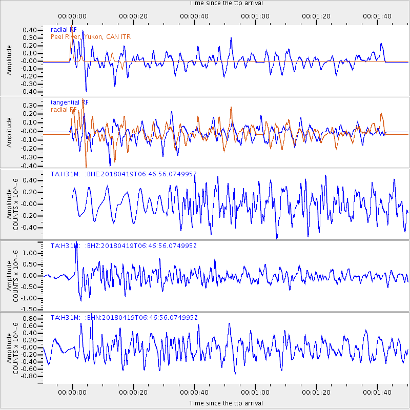
H31M Peel River, Yukon, CAN - Earthquake Result Viewer
*The percent match for this event was below the threshold and hence no stack was calculated.
| Earthquake location: |
Southern Iran |
| Earthquake latitude/longitude: |
28.4/51.6 |
| Earthquake time(UTC): |
2018/04/19 (109) 06:34:47 GMT |
| Earthquake Depth: |
10 km |
| Earthquake Magnitude: |
5.5 Mww |
| Earthquake Catalog/Contributor: |
NEIC PDE/us |
|
| Network: |
TA USArray Transportable Network (new EarthScope stations) |
| Station: |
H31M Peel River, Yukon, CAN |
| Lat/Lon: |
65.81 N/134.34 W |
| Elevation: |
642 m |
|
| Distance: |
86.0 deg |
| Az: |
2.459 deg |
| Baz: |
354.736 deg |
| Ray Param: |
$rayparam |
*The percent match for this event was below the threshold and hence was not used in the summary stack. |
|
| Radial Match: |
54.44869 % |
| Radial Bump: |
400 |
| Transverse Match: |
67.88681 % |
| Transverse Bump: |
400 |
| SOD ConfigId: |
13570011 |
| Insert Time: |
2019-04-30 03:13:11.039 +0000 |
| GWidth: |
2.5 |
| Max Bumps: |
400 |
| Tol: |
0.001 |
|
Signal To Noise
| Channel | StoN | STA | LTA |
| TA:H31M: :BHZ:20180419T06:46:56.074995Z | 4.8105016 | 6.049529E-7 | 1.2575673E-7 |
| TA:H31M: :BHN:20180419T06:46:56.074995Z | 1.0236576 | 2.6598678E-7 | 2.598396E-7 |
| TA:H31M: :BHE:20180419T06:46:56.074995Z | 0.997253 | 1.7468332E-7 | 1.751645E-7 |
| Arrivals |
| Ps | |
| PpPs | |
| PsPs/PpSs | |


