You are here: Home > Network List > TA - USArray Transportable Network (new EarthScope stations) Stations List
> Station I30M Mount Dempster, Yukon, CAN > Earthquake Result Viewer
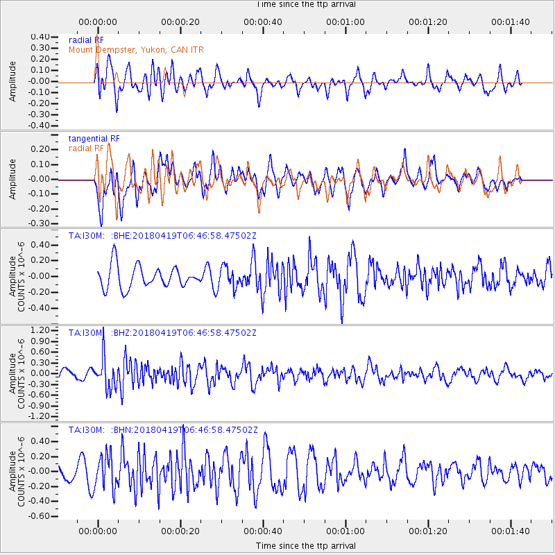
I30M Mount Dempster, Yukon, CAN - Earthquake Result Viewer
*The percent match for this event was below the threshold and hence no stack was calculated.
| Earthquake location: |
Southern Iran |
| Earthquake latitude/longitude: |
28.4/51.6 |
| Earthquake time(UTC): |
2018/04/19 (109) 06:34:47 GMT |
| Earthquake Depth: |
10 km |
| Earthquake Magnitude: |
5.5 Mww |
| Earthquake Catalog/Contributor: |
NEIC PDE/us |
|
| Network: |
TA USArray Transportable Network (new EarthScope stations) |
| Station: |
I30M Mount Dempster, Yukon, CAN |
| Lat/Lon: |
65.22 N/136.38 W |
| Elevation: |
1399 m |
|
| Distance: |
86.5 deg |
| Az: |
3.367 deg |
| Baz: |
352.946 deg |
| Ray Param: |
$rayparam |
*The percent match for this event was below the threshold and hence was not used in the summary stack. |
|
| Radial Match: |
56.752075 % |
| Radial Bump: |
400 |
| Transverse Match: |
56.008427 % |
| Transverse Bump: |
400 |
| SOD ConfigId: |
13570011 |
| Insert Time: |
2019-04-30 03:13:17.603 +0000 |
| GWidth: |
2.5 |
| Max Bumps: |
400 |
| Tol: |
0.001 |
|
Signal To Noise
| Channel | StoN | STA | LTA |
| TA:I30M: :BHZ:20180419T06:46:58.47502Z | 3.8844182 | 4.3375144E-7 | 1.1166445E-7 |
| TA:I30M: :BHN:20180419T06:46:58.47502Z | 1.5606773 | 2.2033835E-7 | 1.4118125E-7 |
| TA:I30M: :BHE:20180419T06:46:58.47502Z | 0.90060335 | 1.2531852E-7 | 1.3914952E-7 |
| Arrivals |
| Ps | |
| PpPs | |
| PsPs/PpSs | |


