You are here: Home > Network List > TA - USArray Transportable Network (new EarthScope stations) Stations List
> Station J20K Nowitna River, AK, USA > Earthquake Result Viewer
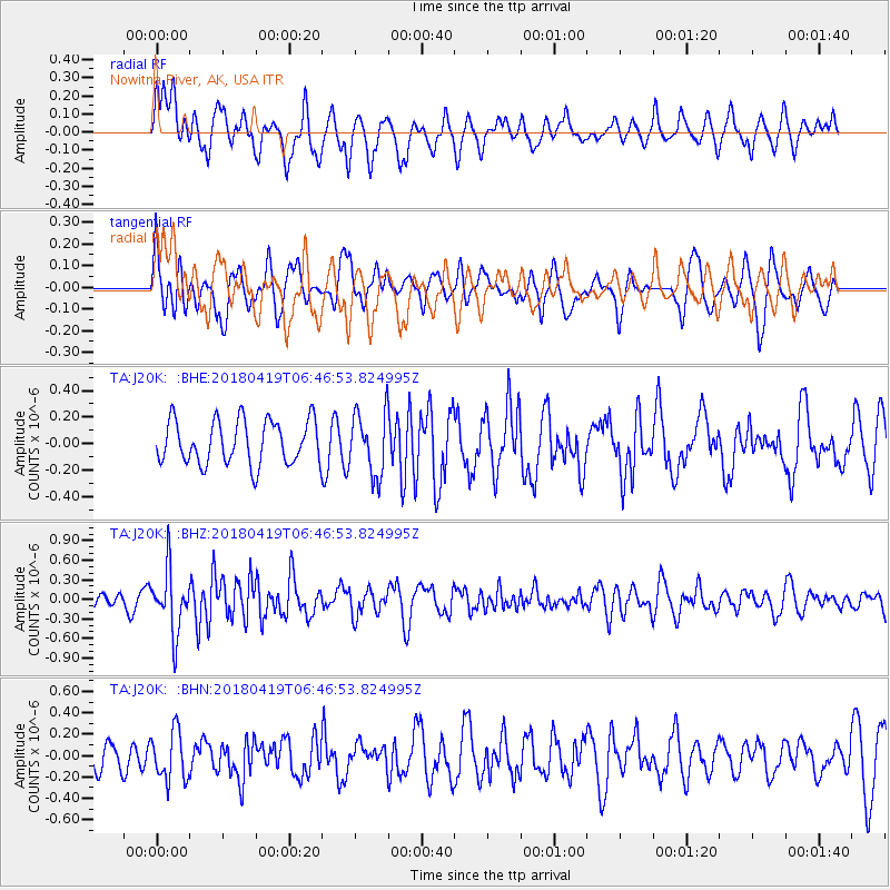
J20K Nowitna River, AK, USA - Earthquake Result Viewer
*The percent match for this event was below the threshold and hence no stack was calculated.
| Earthquake location: |
Southern Iran |
| Earthquake latitude/longitude: |
28.4/51.6 |
| Earthquake time(UTC): |
2018/04/19 (109) 06:34:47 GMT |
| Earthquake Depth: |
10 km |
| Earthquake Magnitude: |
5.5 Mww |
| Earthquake Catalog/Contributor: |
NEIC PDE/us |
|
| Network: |
TA USArray Transportable Network (new EarthScope stations) |
| Station: |
J20K Nowitna River, AK, USA |
| Lat/Lon: |
64.18 N/154.15 W |
| Elevation: |
314 m |
|
| Distance: |
85.6 deg |
| Az: |
11.008 deg |
| Baz: |
337.403 deg |
| Ray Param: |
$rayparam |
*The percent match for this event was below the threshold and hence was not used in the summary stack. |
|
| Radial Match: |
63.205338 % |
| Radial Bump: |
400 |
| Transverse Match: |
52.501163 % |
| Transverse Bump: |
400 |
| SOD ConfigId: |
13570011 |
| Insert Time: |
2019-04-30 03:13:20.368 +0000 |
| GWidth: |
2.5 |
| Max Bumps: |
400 |
| Tol: |
0.001 |
|
Signal To Noise
| Channel | StoN | STA | LTA |
| TA:J20K: :BHZ:20180419T06:46:53.824995Z | 3.881624 | 4.7597922E-7 | 1.2262373E-7 |
| TA:J20K: :BHN:20180419T06:46:53.824995Z | 1.7484728 | 2.2835306E-7 | 1.3060144E-7 |
| TA:J20K: :BHE:20180419T06:46:53.824995Z | 1.4418774 | 2.3989602E-7 | 1.6637756E-7 |
| Arrivals |
| Ps | |
| PpPs | |
| PsPs/PpSs | |


