You are here: Home > Network List > US - United States National Seismic Network Stations List
> Station HAWA Hanford, Washington, USA > Earthquake Result Viewer
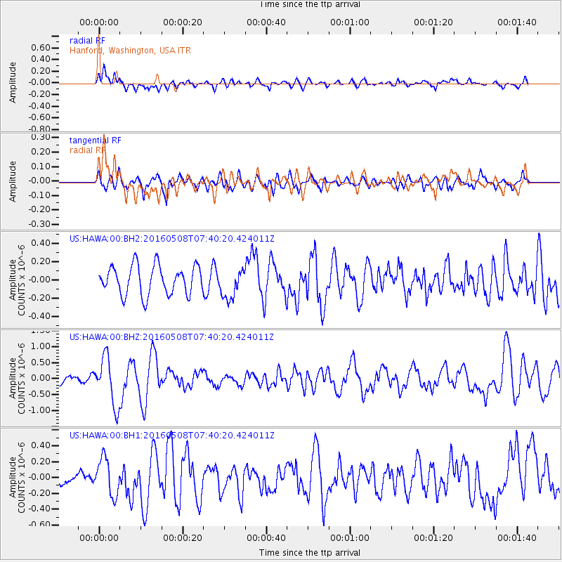
HAWA Hanford, Washington, USA - Earthquake Result Viewer
*The percent match for this event was below the threshold and hence no stack was calculated.
| Earthquake location: |
Oaxaca, Mexico |
| Earthquake latitude/longitude: |
16.6/-97.7 |
| Earthquake time(UTC): |
2016/05/08 (129) 07:34:02 GMT |
| Earthquake Depth: |
24 km |
| Earthquake Magnitude: |
5.9 MB |
| Earthquake Catalog/Contributor: |
NEIC PDE/NEIC ALERT |
|
| Network: |
US United States National Seismic Network |
| Station: |
HAWA Hanford, Washington, USA |
| Lat/Lon: |
46.39 N/119.53 W |
| Elevation: |
364 m |
|
| Distance: |
34.8 deg |
| Az: |
333.217 deg |
| Baz: |
141.366 deg |
| Ray Param: |
$rayparam |
*The percent match for this event was below the threshold and hence was not used in the summary stack. |
|
| Radial Match: |
56.69852 % |
| Radial Bump: |
400 |
| Transverse Match: |
61.799553 % |
| Transverse Bump: |
400 |
| SOD ConfigId: |
1475611 |
| Insert Time: |
2016-05-22 07:39:11.623 +0000 |
| GWidth: |
2.5 |
| Max Bumps: |
400 |
| Tol: |
0.001 |
|
Signal To Noise
| Channel | StoN | STA | LTA |
| US:HAWA:00:BHZ:20160508T07:40:20.424011Z | 3.8438387 | 7.733114E-7 | 2.0118206E-7 |
| US:HAWA:00:BH1:20160508T07:40:20.424011Z | 1.8542943 | 2.4002912E-7 | 1.29445E-7 |
| US:HAWA:00:BH2:20160508T07:40:20.424011Z | 1.0476925 | 1.6512233E-7 | 1.5760571E-7 |
| Arrivals |
| Ps | |
| PpPs | |
| PsPs/PpSs | |


