You are here: Home > Network List > TA - USArray Transportable Network (new EarthScope stations) Stations List
> Station G31M Satah River, YT, CAN > Earthquake Result Viewer
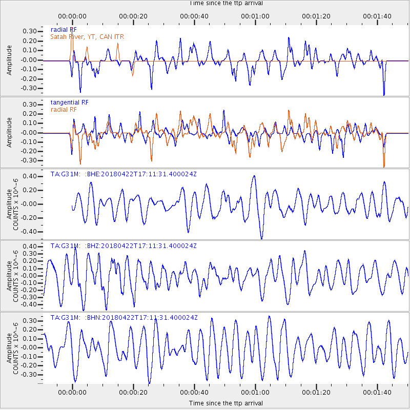
G31M Satah River, YT, CAN - Earthquake Result Viewer
*The percent match for this event was below the threshold and hence no stack was calculated.
| Earthquake location: |
Tonga Islands |
| Earthquake latitude/longitude: |
-15.5/-174.5 |
| Earthquake time(UTC): |
2018/04/22 (112) 16:59:16 GMT |
| Earthquake Depth: |
10 km |
| Earthquake Magnitude: |
5.6 Mww |
| Earthquake Catalog/Contributor: |
NEIC PDE/us |
|
| Network: |
TA USArray Transportable Network (new EarthScope stations) |
| Station: |
G31M Satah River, YT, CAN |
| Lat/Lon: |
66.92 N/134.27 W |
| Elevation: |
61 m |
|
| Distance: |
87.3 deg |
| Az: |
14.761 deg |
| Baz: |
218.553 deg |
| Ray Param: |
$rayparam |
*The percent match for this event was below the threshold and hence was not used in the summary stack. |
|
| Radial Match: |
43.94301 % |
| Radial Bump: |
400 |
| Transverse Match: |
45.957542 % |
| Transverse Bump: |
358 |
| SOD ConfigId: |
13570011 |
| Insert Time: |
2019-04-30 03:24:18.825 +0000 |
| GWidth: |
2.5 |
| Max Bumps: |
400 |
| Tol: |
0.001 |
|
Signal To Noise
| Channel | StoN | STA | LTA |
| TA:G31M: :BHZ:20180422T17:11:31.400024Z | 1.8831235 | 2.52422E-7 | 1.3404431E-7 |
| TA:G31M: :BHN:20180422T17:11:31.400024Z | 1.0795842 | 2.0261251E-7 | 1.8767642E-7 |
| TA:G31M: :BHE:20180422T17:11:31.400024Z | 0.33052212 | 4.9750863E-8 | 1.5052204E-7 |
| Arrivals |
| Ps | |
| PpPs | |
| PsPs/PpSs | |


