You are here: Home > Network List > TA - USArray Transportable Network (new EarthScope stations) Stations List
> Station E20K Nigu River, AK, USA > Earthquake Result Viewer
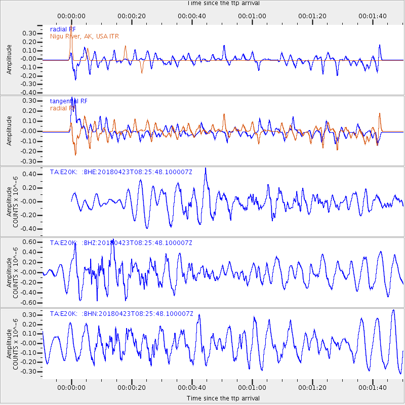
E20K Nigu River, AK, USA - Earthquake Result Viewer
*The percent match for this event was below the threshold and hence no stack was calculated.
| Earthquake location: |
Near North Coast Of Irian Jaya |
| Earthquake latitude/longitude: |
-1.3/138.4 |
| Earthquake time(UTC): |
2018/04/23 (113) 08:13:58 GMT |
| Earthquake Depth: |
10 km |
| Earthquake Magnitude: |
5.6 Mww |
| Earthquake Catalog/Contributor: |
NEIC PDE/us |
|
| Network: |
TA USArray Transportable Network (new EarthScope stations) |
| Station: |
E20K Nigu River, AK, USA |
| Lat/Lon: |
68.26 N/156.19 W |
| Elevation: |
866 m |
|
| Distance: |
82.3 deg |
| Az: |
19.988 deg |
| Baz: |
246.522 deg |
| Ray Param: |
$rayparam |
*The percent match for this event was below the threshold and hence was not used in the summary stack. |
|
| Radial Match: |
59.728035 % |
| Radial Bump: |
400 |
| Transverse Match: |
49.454266 % |
| Transverse Bump: |
400 |
| SOD ConfigId: |
13570011 |
| Insert Time: |
2019-04-30 03:29:03.322 +0000 |
| GWidth: |
2.5 |
| Max Bumps: |
400 |
| Tol: |
0.001 |
|
Signal To Noise
| Channel | StoN | STA | LTA |
| TA:E20K: :BHZ:20180423T08:25:48.100007Z | 2.2555137 | 3.1531488E-7 | 1.3979738E-7 |
| TA:E20K: :BHN:20180423T08:25:48.100007Z | 0.81549126 | 1.444944E-7 | 1.7718692E-7 |
| TA:E20K: :BHE:20180423T08:25:48.100007Z | 1.6049753 | 1.9038298E-7 | 1.18620505E-7 |
| Arrivals |
| Ps | |
| PpPs | |
| PsPs/PpSs | |


