You are here: Home > Network List > TA - USArray Transportable Network (new EarthScope stations) Stations List
> Station MSTX Muleshoe, TX, USA > Earthquake Result Viewer
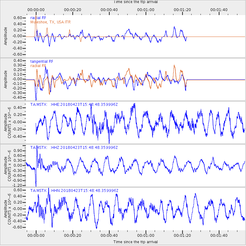
MSTX Muleshoe, TX, USA - Earthquake Result Viewer
*The percent match for this event was below the threshold and hence no stack was calculated.
| Earthquake location: |
Colombia |
| Earthquake latitude/longitude: |
5.2/-75.5 |
| Earthquake time(UTC): |
2018/04/23 (113) 15:42:10 GMT |
| Earthquake Depth: |
113 km |
| Earthquake Magnitude: |
5.2 Mww |
| Earthquake Catalog/Contributor: |
NEIC PDE/us |
|
| Network: |
TA USArray Transportable Network (new EarthScope stations) |
| Station: |
MSTX Muleshoe, TX, USA |
| Lat/Lon: |
33.97 N/102.77 W |
| Elevation: |
1167 m |
|
| Distance: |
38.2 deg |
| Az: |
322.051 deg |
| Baz: |
132.525 deg |
| Ray Param: |
$rayparam |
*The percent match for this event was below the threshold and hence was not used in the summary stack. |
|
| Radial Match: |
56.628227 % |
| Radial Bump: |
400 |
| Transverse Match: |
73.85295 % |
| Transverse Bump: |
400 |
| SOD ConfigId: |
13570011 |
| Insert Time: |
2019-04-30 03:37:57.222 +0000 |
| GWidth: |
2.5 |
| Max Bumps: |
400 |
| Tol: |
0.001 |
|
Signal To Noise
| Channel | StoN | STA | LTA |
| TA:MSTX: :HHZ:20180423T15:48:48.359996Z | 2.8779945 | 4.7567997E-7 | 1.6528175E-7 |
| TA:MSTX: :HHN:20180423T15:48:48.359996Z | 1.1536174 | 2.1369016E-7 | 1.8523485E-7 |
| TA:MSTX: :HHE:20180423T15:48:48.359996Z | 1.1584358 | 2.3121042E-7 | 1.9958846E-7 |
| Arrivals |
| Ps | |
| PpPs | |
| PsPs/PpSs | |


