You are here: Home > Network List > TA - USArray Transportable Network (new EarthScope stations) Stations List
> Station H16K Elim, AK, USA > Earthquake Result Viewer
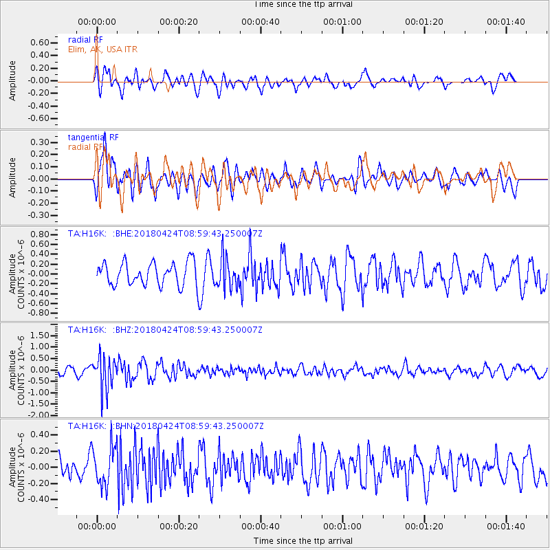
H16K Elim, AK, USA - Earthquake Result Viewer
*The percent match for this event was below the threshold and hence no stack was calculated.
| Earthquake location: |
Hokkaido, Japan Region |
| Earthquake latitude/longitude: |
43.4/145.7 |
| Earthquake time(UTC): |
2018/04/24 (114) 08:53:21 GMT |
| Earthquake Depth: |
80 km |
| Earthquake Magnitude: |
5.5 Mww |
| Earthquake Catalog/Contributor: |
NEIC PDE/us |
|
| Network: |
TA USArray Transportable Network (new EarthScope stations) |
| Station: |
H16K Elim, AK, USA |
| Lat/Lon: |
64.64 N/162.24 W |
| Elevation: |
216 m |
|
| Distance: |
35.8 deg |
| Az: |
35.442 deg |
| Baz: |
259.123 deg |
| Ray Param: |
$rayparam |
*The percent match for this event was below the threshold and hence was not used in the summary stack. |
|
| Radial Match: |
53.435368 % |
| Radial Bump: |
400 |
| Transverse Match: |
68.45096 % |
| Transverse Bump: |
400 |
| SOD ConfigId: |
13570011 |
| Insert Time: |
2019-04-30 03:54:32.156 +0000 |
| GWidth: |
2.5 |
| Max Bumps: |
400 |
| Tol: |
0.001 |
|
Signal To Noise
| Channel | StoN | STA | LTA |
| TA:H16K: :BHZ:20180424T08:59:43.250007Z | 4.111768 | 7.263552E-7 | 1.7665278E-7 |
| TA:H16K: :BHN:20180424T08:59:43.250007Z | 1.822932 | 2.4600538E-7 | 1.349504E-7 |
| TA:H16K: :BHE:20180424T08:59:43.250007Z | 1.3299973 | 3.0656025E-7 | 2.304969E-7 |
| Arrivals |
| Ps | |
| PpPs | |
| PsPs/PpSs | |


