You are here: Home > Network List > CN - Canadian National Seismograph Network Stations List
> Station INK INUVIK, NT > Earthquake Result Viewer
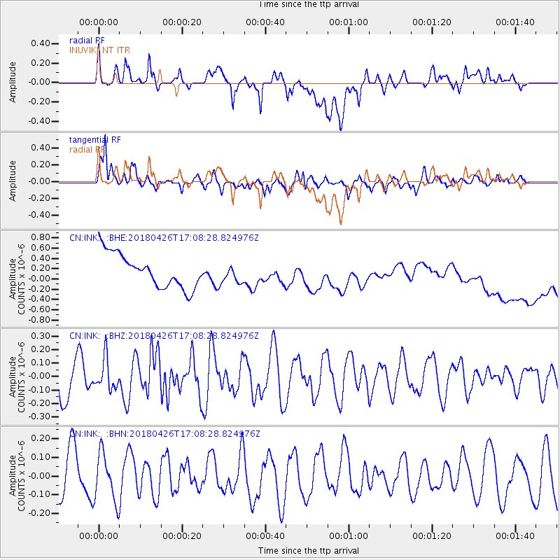
INK INUVIK, NT - Earthquake Result Viewer
*The percent match for this event was below the threshold and hence no stack was calculated.
| Earthquake location: |
Near North Coast Of Irian Jaya |
| Earthquake latitude/longitude: |
-1.9/139.8 |
| Earthquake time(UTC): |
2018/04/26 (116) 16:55:58 GMT |
| Earthquake Depth: |
10 km |
| Earthquake Magnitude: |
5.6 Mww |
| Earthquake Catalog/Contributor: |
NEIC PDE/us |
|
| Network: |
CN Canadian National Seismograph Network |
| Station: |
INK INUVIK, NT |
| Lat/Lon: |
68.31 N/133.53 W |
| Elevation: |
44 m |
|
| Distance: |
90.5 deg |
| Az: |
21.789 deg |
| Baz: |
266.23 deg |
| Ray Param: |
$rayparam |
*The percent match for this event was below the threshold and hence was not used in the summary stack. |
|
| Radial Match: |
15.735146 % |
| Radial Bump: |
400 |
| Transverse Match: |
72.74514 % |
| Transverse Bump: |
400 |
| SOD ConfigId: |
13570011 |
| Insert Time: |
2019-04-30 04:03:26.310 +0000 |
| GWidth: |
2.5 |
| Max Bumps: |
400 |
| Tol: |
0.001 |
|
Signal To Noise
| Channel | StoN | STA | LTA |
| CN:INK: :BHZ:20180426T17:08:28.824976Z | 0.6446216 | 1.1607417E-7 | 1.8006558E-7 |
| CN:INK: :BHN:20180426T17:08:28.824976Z | 0.7642802 | 1.2940282E-7 | 1.6931332E-7 |
| CN:INK: :BHE:20180426T17:08:28.824976Z | 0.5395449 | 1.748982E-7 | 3.2415878E-7 |
| Arrivals |
| Ps | |
| PpPs | |
| PsPs/PpSs | |


