You are here: Home > Network List > US - United States National Seismic Network Stations List
> Station DGMT Dagmar, Montana, USA > Earthquake Result Viewer
DGMT Dagmar, Montana, USA - Earthquake Result Viewer
*The percent match for this event was below the threshold and hence no stack was calculated.
| Earthquake location: |
Taiwan |
| Earthquake latitude/longitude: |
24.7/122.0 |
| Earthquake time(UTC): |
2016/05/12 (133) 03:17:16 GMT |
| Earthquake Depth: |
10 km |
| Earthquake Magnitude: |
5.6 MB |
| Earthquake Catalog/Contributor: |
NEIC PDE/NEIC COMCAT |
|
| Network: |
US United States National Seismic Network |
| Station: |
DGMT Dagmar, Montana, USA |
| Lat/Lon: |
48.47 N/104.20 W |
| Elevation: |
0.0 m |
|
| Distance: |
96.3 deg |
| Az: |
28.877 deg |
| Baz: |
318.687 deg |
| Ray Param: |
$rayparam |
*The percent match for this event was below the threshold and hence was not used in the summary stack. |
|
| Radial Match: |
66.20818 % |
| Radial Bump: |
400 |
| Transverse Match: |
61.154797 % |
| Transverse Bump: |
400 |
| SOD ConfigId: |
1475611 |
| Insert Time: |
2016-05-26 03:21:25.619 +0000 |
| GWidth: |
2.5 |
| Max Bumps: |
400 |
| Tol: |
0.001 |
|
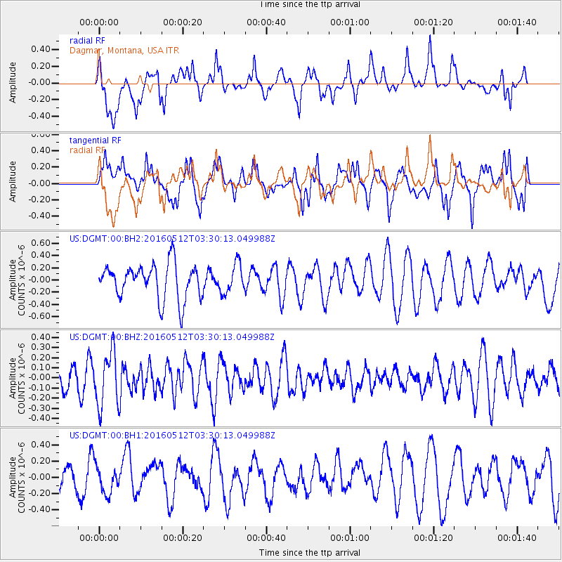
Signal To Noise
| Channel | StoN | STA | LTA |
| US:DGMT:00:BHZ:20160512T03:30:13.049988Z | 1.9481562 | 2.757377E-7 | 1.4153777E-7 |
| US:DGMT:00:BH1:20160512T03:30:13.049988Z | 1.0358973 | 1.5723552E-7 | 1.517868E-7 |
| US:DGMT:00:BH2:20160512T03:30:13.049988Z | 0.8718987 | 2.503195E-7 | 2.8709698E-7 |
| Arrivals |
| Ps | |
| PpPs | |
| PsPs/PpSs | |


