You are here: Home > Network List > TA - USArray Transportable Network (new EarthScope stations) Stations List
> Station J26L Joseph Creek, AK, USA > Earthquake Result Viewer
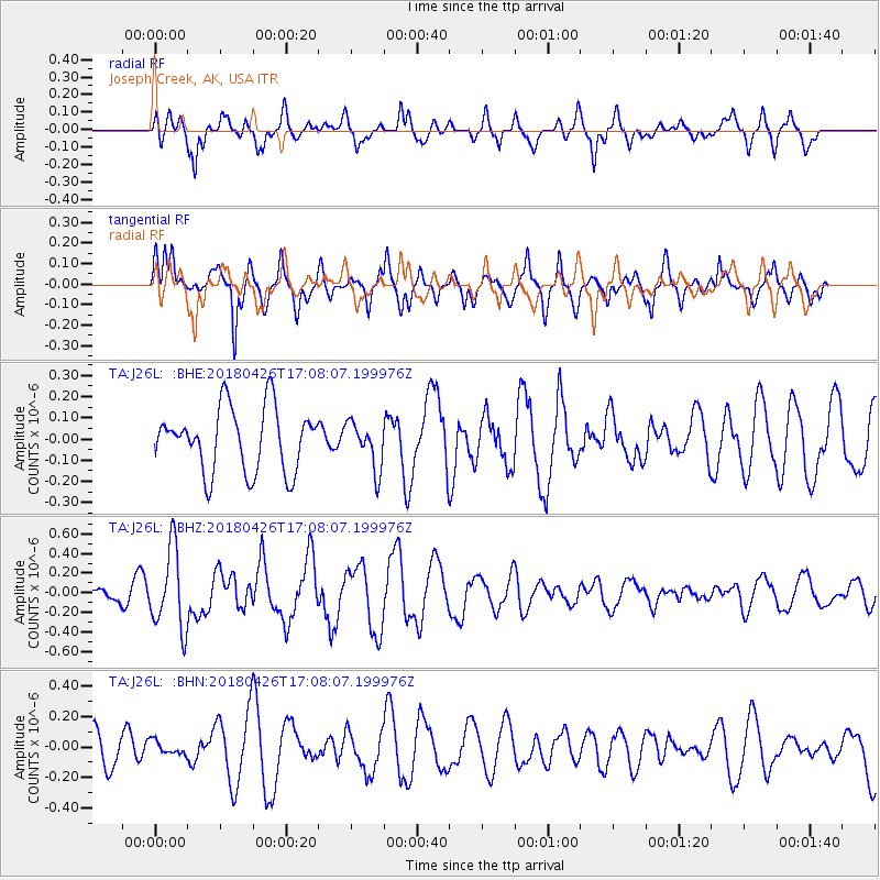
J26L Joseph Creek, AK, USA - Earthquake Result Viewer
*The percent match for this event was below the threshold and hence no stack was calculated.
| Earthquake location: |
Near North Coast Of Irian Jaya |
| Earthquake latitude/longitude: |
-1.9/139.8 |
| Earthquake time(UTC): |
2018/04/26 (116) 16:55:58 GMT |
| Earthquake Depth: |
10 km |
| Earthquake Magnitude: |
5.6 Mww |
| Earthquake Catalog/Contributor: |
NEIC PDE/us |
|
| Network: |
TA USArray Transportable Network (new EarthScope stations) |
| Station: |
J26L Joseph Creek, AK, USA |
| Lat/Lon: |
64.50 N/143.56 W |
| Elevation: |
1144 m |
|
| Distance: |
86.0 deg |
| Az: |
24.974 deg |
| Baz: |
257.129 deg |
| Ray Param: |
$rayparam |
*The percent match for this event was below the threshold and hence was not used in the summary stack. |
|
| Radial Match: |
68.18511 % |
| Radial Bump: |
383 |
| Transverse Match: |
75.73145 % |
| Transverse Bump: |
369 |
| SOD ConfigId: |
13570011 |
| Insert Time: |
2019-04-30 04:05:44.554 +0000 |
| GWidth: |
2.5 |
| Max Bumps: |
400 |
| Tol: |
0.001 |
|
Signal To Noise
| Channel | StoN | STA | LTA |
| TA:J26L: :BHZ:20180426T17:08:07.199976Z | 3.6477857 | 4.1147402E-7 | 1.1280104E-7 |
| TA:J26L: :BHN:20180426T17:08:07.199976Z | 0.440219 | 4.4673893E-8 | 1.0148106E-7 |
| TA:J26L: :BHE:20180426T17:08:07.199976Z | 0.7427203 | 1.1074733E-7 | 1.4911042E-7 |
| Arrivals |
| Ps | |
| PpPs | |
| PsPs/PpSs | |


