You are here: Home > Network List > TA - USArray Transportable Network (new EarthScope stations) Stations List
> Station R32K Eaglecrest, AK, USA > Earthquake Result Viewer
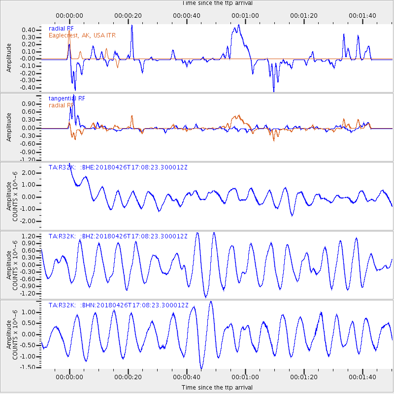
R32K Eaglecrest, AK, USA - Earthquake Result Viewer
*The percent match for this event was below the threshold and hence no stack was calculated.
| Earthquake location: |
Near North Coast Of Irian Jaya |
| Earthquake latitude/longitude: |
-1.9/139.8 |
| Earthquake time(UTC): |
2018/04/26 (116) 16:55:58 GMT |
| Earthquake Depth: |
10 km |
| Earthquake Magnitude: |
5.6 Mww |
| Earthquake Catalog/Contributor: |
NEIC PDE/us |
|
| Network: |
TA USArray Transportable Network (new EarthScope stations) |
| Station: |
R32K Eaglecrest, AK, USA |
| Lat/Lon: |
58.27 N/134.52 W |
| Elevation: |
386 m |
|
| Distance: |
89.3 deg |
| Az: |
31.8 deg |
| Baz: |
265.353 deg |
| Ray Param: |
$rayparam |
*The percent match for this event was below the threshold and hence was not used in the summary stack. |
|
| Radial Match: |
43.181465 % |
| Radial Bump: |
400 |
| Transverse Match: |
87.47559 % |
| Transverse Bump: |
400 |
| SOD ConfigId: |
13570011 |
| Insert Time: |
2019-04-30 04:06:03.504 +0000 |
| GWidth: |
2.5 |
| Max Bumps: |
400 |
| Tol: |
0.001 |
|
Signal To Noise
| Channel | StoN | STA | LTA |
| TA:R32K: :BHZ:20180426T17:08:23.300012Z | 1.1032065 | 6.010141E-7 | 5.447884E-7 |
| TA:R32K: :BHN:20180426T17:08:23.300012Z | 1.0301884 | 6.7040867E-7 | 6.507632E-7 |
| TA:R32K: :BHE:20180426T17:08:23.300012Z | 0.9930944 | 8.546384E-7 | 8.605812E-7 |
| Arrivals |
| Ps | |
| PpPs | |
| PsPs/PpSs | |


