You are here: Home > Network List > TA - USArray Transportable Network (new EarthScope stations) Stations List
> Station F20K Avaraart Lake, AK, USA > Earthquake Result Viewer
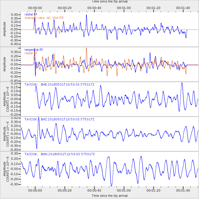
F20K Avaraart Lake, AK, USA - Earthquake Result Viewer
*The percent match for this event was below the threshold and hence no stack was calculated.
| Earthquake location: |
Fiji Islands Region |
| Earthquake latitude/longitude: |
-18.0/-178.0 |
| Earthquake time(UTC): |
2018/05/01 (121) 19:47:53 GMT |
| Earthquake Depth: |
579 km |
| Earthquake Magnitude: |
5.9 Mww |
| Earthquake Catalog/Contributor: |
NEIC PDE/us |
|
| Network: |
TA USArray Transportable Network (new EarthScope stations) |
| Station: |
F20K Avaraart Lake, AK, USA |
| Lat/Lon: |
67.05 N/155.73 W |
| Elevation: |
136 m |
|
| Distance: |
86.4 deg |
| Az: |
8.556 deg |
| Baz: |
201.166 deg |
| Ray Param: |
$rayparam |
*The percent match for this event was below the threshold and hence was not used in the summary stack. |
|
| Radial Match: |
57.47296 % |
| Radial Bump: |
400 |
| Transverse Match: |
40.932312 % |
| Transverse Bump: |
400 |
| SOD ConfigId: |
13570011 |
| Insert Time: |
2019-04-30 04:26:06.055 +0000 |
| GWidth: |
2.5 |
| Max Bumps: |
400 |
| Tol: |
0.001 |
|
Signal To Noise
| Channel | StoN | STA | LTA |
| TA:F20K: :BHZ:20180501T19:59:03.575017Z | 2.7330914 | 1.9103193E-7 | 6.989592E-8 |
| TA:F20K: :BHN:20180501T19:59:03.575017Z | 1.0308576 | 1.1904738E-7 | 1.15483836E-7 |
| TA:F20K: :BHE:20180501T19:59:03.575017Z | 0.6302215 | 4.29271E-8 | 6.81143E-8 |
| Arrivals |
| Ps | |
| PpPs | |
| PsPs/PpSs | |


