You are here: Home > Network List > TA - USArray Transportable Network (new EarthScope stations) Stations List
> Station G21K Allakaket, AK, USA > Earthquake Result Viewer
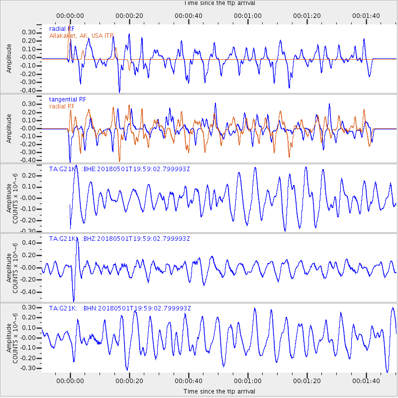
G21K Allakaket, AK, USA - Earthquake Result Viewer
*The percent match for this event was below the threshold and hence no stack was calculated.
| Earthquake location: |
Fiji Islands Region |
| Earthquake latitude/longitude: |
-18.0/-178.0 |
| Earthquake time(UTC): |
2018/05/01 (121) 19:47:53 GMT |
| Earthquake Depth: |
579 km |
| Earthquake Magnitude: |
5.9 Mww |
| Earthquake Catalog/Contributor: |
NEIC PDE/us |
|
| Network: |
TA USArray Transportable Network (new EarthScope stations) |
| Station: |
G21K Allakaket, AK, USA |
| Lat/Lon: |
66.52 N/153.51 W |
| Elevation: |
446 m |
|
| Distance: |
86.2 deg |
| Az: |
9.575 deg |
| Baz: |
203.269 deg |
| Ray Param: |
$rayparam |
*The percent match for this event was below the threshold and hence was not used in the summary stack. |
|
| Radial Match: |
63.612392 % |
| Radial Bump: |
387 |
| Transverse Match: |
62.206745 % |
| Transverse Bump: |
360 |
| SOD ConfigId: |
13570011 |
| Insert Time: |
2019-04-30 04:26:10.473 +0000 |
| GWidth: |
2.5 |
| Max Bumps: |
400 |
| Tol: |
0.001 |
|
Signal To Noise
| Channel | StoN | STA | LTA |
| TA:G21K: :BHZ:20180501T19:59:02.799993Z | 2.7468934 | 2.5043434E-7 | 9.117002E-8 |
| TA:G21K: :BHN:20180501T19:59:02.799993Z | 1.0585909 | 1.02437724E-7 | 9.676799E-8 |
| TA:G21K: :BHE:20180501T19:59:02.799993Z | 0.4453096 | 4.726383E-8 | 1.0613701E-7 |
| Arrivals |
| Ps | |
| PpPs | |
| PsPs/PpSs | |


