You are here: Home > Network List > TA - USArray Transportable Network (new EarthScope stations) Stations List
> Station G31M Satah River, YT, CAN > Earthquake Result Viewer
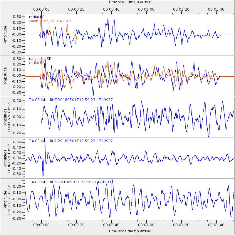
G31M Satah River, YT, CAN - Earthquake Result Viewer
*The percent match for this event was below the threshold and hence no stack was calculated.
| Earthquake location: |
Fiji Islands Region |
| Earthquake latitude/longitude: |
-18.0/-178.0 |
| Earthquake time(UTC): |
2018/05/01 (121) 19:47:53 GMT |
| Earthquake Depth: |
579 km |
| Earthquake Magnitude: |
5.9 Mww |
| Earthquake Catalog/Contributor: |
NEIC PDE/us |
|
| Network: |
TA USArray Transportable Network (new EarthScope stations) |
| Station: |
G31M Satah River, YT, CAN |
| Lat/Lon: |
66.92 N/134.27 W |
| Elevation: |
61 m |
|
| Distance: |
90.6 deg |
| Az: |
15.806 deg |
| Baz: |
221.118 deg |
| Ray Param: |
$rayparam |
*The percent match for this event was below the threshold and hence was not used in the summary stack. |
|
| Radial Match: |
44.372852 % |
| Radial Bump: |
400 |
| Transverse Match: |
72.659706 % |
| Transverse Bump: |
400 |
| SOD ConfigId: |
13570011 |
| Insert Time: |
2019-04-30 04:26:14.140 +0000 |
| GWidth: |
2.5 |
| Max Bumps: |
400 |
| Tol: |
0.001 |
|
Signal To Noise
| Channel | StoN | STA | LTA |
| TA:G31M: :BHZ:20180501T19:59:23.174993Z | 4.8300695 | 3.1022566E-7 | 6.4228E-8 |
| TA:G31M: :BHN:20180501T19:59:23.174993Z | 1.3658677 | 1.0749514E-7 | 7.870099E-8 |
| TA:G31M: :BHE:20180501T19:59:23.174993Z | 1.1270962 | 8.3770026E-8 | 7.432376E-8 |
| Arrivals |
| Ps | |
| PpPs | |
| PsPs/PpSs | |


