You are here: Home > Network List > TA - USArray Transportable Network (new EarthScope stations) Stations List
> Station I23K Minto, Yukon-Koyukuk, AK, USA > Earthquake Result Viewer
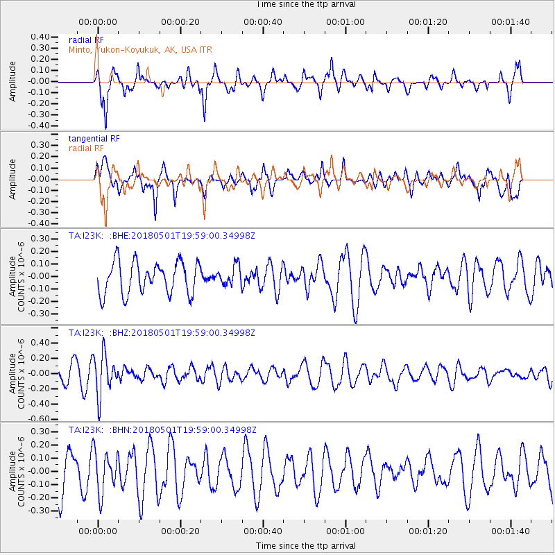
I23K Minto, Yukon-Koyukuk, AK, USA - Earthquake Result Viewer
*The percent match for this event was below the threshold and hence no stack was calculated.
| Earthquake location: |
Fiji Islands Region |
| Earthquake latitude/longitude: |
-18.0/-178.0 |
| Earthquake time(UTC): |
2018/05/01 (121) 19:47:53 GMT |
| Earthquake Depth: |
579 km |
| Earthquake Magnitude: |
5.9 Mww |
| Earthquake Catalog/Contributor: |
NEIC PDE/us |
|
| Network: |
TA USArray Transportable Network (new EarthScope stations) |
| Station: |
I23K Minto, Yukon-Koyukuk, AK, USA |
| Lat/Lon: |
65.15 N/149.36 W |
| Elevation: |
149 m |
|
| Distance: |
85.7 deg |
| Az: |
11.71 deg |
| Baz: |
207.198 deg |
| Ray Param: |
$rayparam |
*The percent match for this event was below the threshold and hence was not used in the summary stack. |
|
| Radial Match: |
52.171913 % |
| Radial Bump: |
384 |
| Transverse Match: |
57.521408 % |
| Transverse Bump: |
390 |
| SOD ConfigId: |
13570011 |
| Insert Time: |
2019-04-30 04:26:21.835 +0000 |
| GWidth: |
2.5 |
| Max Bumps: |
400 |
| Tol: |
0.001 |
|
Signal To Noise
| Channel | StoN | STA | LTA |
| TA:I23K: :BHZ:20180501T19:59:00.34998Z | 1.7773863 | 2.7021872E-7 | 1.5203152E-7 |
| TA:I23K: :BHN:20180501T19:59:00.34998Z | 0.98384744 | 1.510173E-7 | 1.5349667E-7 |
| TA:I23K: :BHE:20180501T19:59:00.34998Z | 0.6389383 | 8.2818836E-8 | 1.2961947E-7 |
| Arrivals |
| Ps | |
| PpPs | |
| PsPs/PpSs | |


