You are here: Home > Network List > TA - USArray Transportable Network (new EarthScope stations) Stations List
> Station R33M Jennings River, BC, CAN > Earthquake Result Viewer
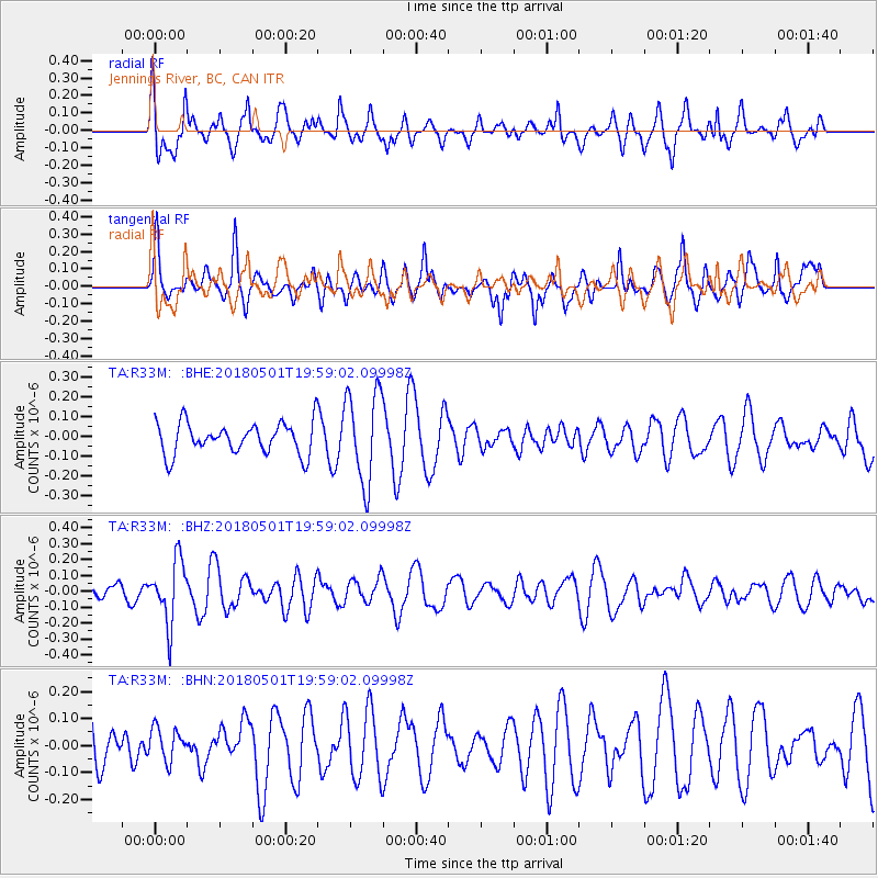
R33M Jennings River, BC, CAN - Earthquake Result Viewer
*The percent match for this event was below the threshold and hence no stack was calculated.
| Earthquake location: |
Fiji Islands Region |
| Earthquake latitude/longitude: |
-18.0/-178.0 |
| Earthquake time(UTC): |
2018/05/01 (121) 19:47:53 GMT |
| Earthquake Depth: |
579 km |
| Earthquake Magnitude: |
5.9 Mww |
| Earthquake Catalog/Contributor: |
NEIC PDE/us |
|
| Network: |
TA USArray Transportable Network (new EarthScope stations) |
| Station: |
R33M Jennings River, BC, CAN |
| Lat/Lon: |
59.39 N/130.97 W |
| Elevation: |
1437 m |
|
| Distance: |
86.1 deg |
| Az: |
22.032 deg |
| Baz: |
224.248 deg |
| Ray Param: |
$rayparam |
*The percent match for this event was below the threshold and hence was not used in the summary stack. |
|
| Radial Match: |
78.820015 % |
| Radial Bump: |
400 |
| Transverse Match: |
67.104324 % |
| Transverse Bump: |
379 |
| SOD ConfigId: |
13570011 |
| Insert Time: |
2019-04-30 04:27:04.203 +0000 |
| GWidth: |
2.5 |
| Max Bumps: |
400 |
| Tol: |
0.001 |
|
Signal To Noise
| Channel | StoN | STA | LTA |
| TA:R33M: :BHZ:20180501T19:59:02.09998Z | 2.3476498 | 1.9556899E-7 | 8.330416E-8 |
| TA:R33M: :BHN:20180501T19:59:02.09998Z | 0.64580095 | 6.2039106E-8 | 9.606537E-8 |
| TA:R33M: :BHE:20180501T19:59:02.09998Z | 2.9007528 | 2.3244635E-7 | 8.013311E-8 |
| Arrivals |
| Ps | |
| PpPs | |
| PsPs/PpSs | |


