You are here: Home > Network List > TA - USArray Transportable Network (new EarthScope stations) Stations List
> Station C16K Lisburne Hills, AK, USA > Earthquake Result Viewer
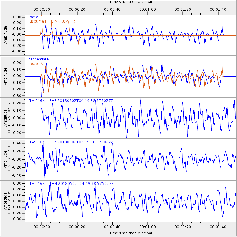
C16K Lisburne Hills, AK, USA - Earthquake Result Viewer
*The percent match for this event was below the threshold and hence no stack was calculated.
| Earthquake location: |
Northern And Central Iran |
| Earthquake latitude/longitude: |
30.7/51.5 |
| Earthquake time(UTC): |
2018/05/02 (122) 04:08:13 GMT |
| Earthquake Depth: |
10 km |
| Earthquake Magnitude: |
5.3 Mww |
| Earthquake Catalog/Contributor: |
NEIC PDE/us |
|
| Network: |
TA USArray Transportable Network (new EarthScope stations) |
| Station: |
C16K Lisburne Hills, AK, USA |
| Lat/Lon: |
68.27 N/165.34 W |
| Elevation: |
102 m |
|
| Distance: |
77.6 deg |
| Az: |
13.21 deg |
| Baz: |
328.089 deg |
| Ray Param: |
$rayparam |
*The percent match for this event was below the threshold and hence was not used in the summary stack. |
|
| Radial Match: |
47.88728 % |
| Radial Bump: |
400 |
| Transverse Match: |
58.96884 % |
| Transverse Bump: |
400 |
| SOD ConfigId: |
13570011 |
| Insert Time: |
2019-04-30 04:32:45.688 +0000 |
| GWidth: |
2.5 |
| Max Bumps: |
400 |
| Tol: |
0.001 |
|
Signal To Noise
| Channel | StoN | STA | LTA |
| TA:C16K: :BHZ:20180502T04:19:38.575027Z | 1.8940791 | 1.9825656E-7 | 1.0467174E-7 |
| TA:C16K: :BHN:20180502T04:19:38.575027Z | 2.0643463 | 1.7476576E-7 | 8.465913E-8 |
| TA:C16K: :BHE:20180502T04:19:38.575027Z | 1.4466548 | 1.3191236E-7 | 9.1184404E-8 |
| Arrivals |
| Ps | |
| PpPs | |
| PsPs/PpSs | |


