You are here: Home > Network List > US - United States National Seismic Network Stations List
> Station DGMT Dagmar, Montana, USA > Earthquake Result Viewer
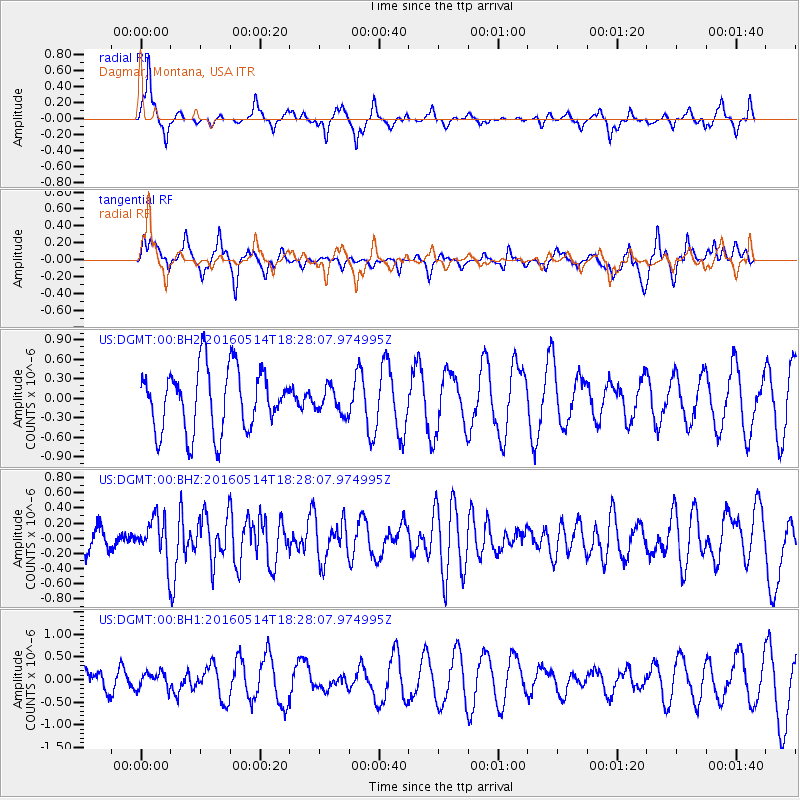
DGMT Dagmar, Montana, USA - Earthquake Result Viewer
*The percent match for this event was below the threshold and hence no stack was calculated.
| Earthquake location: |
Northern East Pacific Rise |
| Earthquake latitude/longitude: |
8.5/-102.8 |
| Earthquake time(UTC): |
2016/05/14 (135) 18:21:05 GMT |
| Earthquake Depth: |
10 km |
| Earthquake Magnitude: |
5.8 MWW, 5.6 MWB, 5.7 MWC |
| Earthquake Catalog/Contributor: |
NEIC PDE/NEIC COMCAT |
|
| Network: |
US United States National Seismic Network |
| Station: |
DGMT Dagmar, Montana, USA |
| Lat/Lon: |
48.47 N/104.20 W |
| Elevation: |
0.0 m |
|
| Distance: |
39.8 deg |
| Az: |
358.591 deg |
| Baz: |
177.906 deg |
| Ray Param: |
$rayparam |
*The percent match for this event was below the threshold and hence was not used in the summary stack. |
|
| Radial Match: |
48.323532 % |
| Radial Bump: |
263 |
| Transverse Match: |
43.442307 % |
| Transverse Bump: |
345 |
| SOD ConfigId: |
1475611 |
| Insert Time: |
2016-05-28 18:27:02.568 +0000 |
| GWidth: |
2.5 |
| Max Bumps: |
400 |
| Tol: |
0.001 |
|
Signal To Noise
| Channel | StoN | STA | LTA |
| US:DGMT:00:BHZ:20160514T18:28:07.974995Z | 2.0128422 | 2.743525E-7 | 1.3630104E-7 |
| US:DGMT:00:BH1:20160514T18:28:07.974995Z | 0.7820605 | 1.7893929E-7 | 2.2880491E-7 |
| US:DGMT:00:BH2:20160514T18:28:07.974995Z | 0.39920744 | 1.926103E-7 | 4.824817E-7 |
| Arrivals |
| Ps | |
| PpPs | |
| PsPs/PpSs | |


