You are here: Home > Network List > TA - USArray Transportable Network (new EarthScope stations) Stations List
> Station 123A Bell Site, White Sands Missle Range, NM, USA > Earthquake Result Viewer
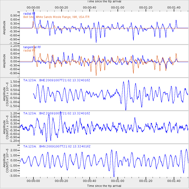
123A Bell Site, White Sands Missle Range, NM, USA - Earthquake Result Viewer
*The percent match for this event was below the threshold and hence no stack was calculated.
| Earthquake location: |
East Of Severnaya Zemlya |
| Earthquake latitude/longitude: |
81.6/119.5 |
| Earthquake time(UTC): |
2009/10/07 (280) 20:52:13 GMT |
| Earthquake Depth: |
8.0 km |
| Earthquake Magnitude: |
5.7 MB, 5.1 MS, 5.8 MW, 5.8 MW |
| Earthquake Catalog/Contributor: |
WHDF/NEIC |
|
| Network: |
TA USArray Transportable Network (new EarthScope stations) |
| Station: |
123A Bell Site, White Sands Missle Range, NM, USA |
| Lat/Lon: |
32.63 N/106.26 W |
| Elevation: |
1206 m |
|
| Distance: |
63.6 deg |
| Az: |
42.459 deg |
| Baz: |
353.221 deg |
| Ray Param: |
$rayparam |
*The percent match for this event was below the threshold and hence was not used in the summary stack. |
|
| Radial Match: |
77.70595 % |
| Radial Bump: |
357 |
| Transverse Match: |
65.698746 % |
| Transverse Bump: |
295 |
| SOD ConfigId: |
2622 |
| Insert Time: |
2010-03-06 10:50:30.011 +0000 |
| GWidth: |
2.5 |
| Max Bumps: |
400 |
| Tol: |
0.001 |
|
Signal To Noise
| Channel | StoN | STA | LTA |
| TA:123A: :BHZ:20091007T21:02:13.324016Z | 2.4326017 | 4.2890883E-7 | 1.7631692E-7 |
| TA:123A: :BHN:20091007T21:02:13.324016Z | 0.9812596 | 6.33457E-7 | 6.4555496E-7 |
| TA:123A: :BHE:20091007T21:02:13.324016Z | 0.7417827 | 4.3721684E-7 | 5.894136E-7 |
| Arrivals |
| Ps | |
| PpPs | |
| PsPs/PpSs | |


