You are here: Home > Network List > TA - USArray Transportable Network (new EarthScope stations) Stations List
> Station 123A Bell Site, White Sands Missle Range, NM, USA > Earthquake Result Viewer
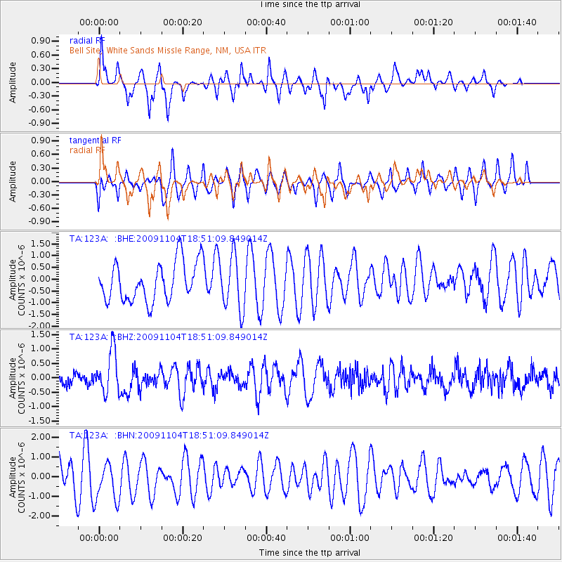
123A Bell Site, White Sands Missle Range, NM, USA - Earthquake Result Viewer
*The percent match for this event was below the threshold and hence no stack was calculated.
| Earthquake location: |
Azores Islands Region |
| Earthquake latitude/longitude: |
36.2/-33.9 |
| Earthquake time(UTC): |
2009/11/04 (308) 18:41:44 GMT |
| Earthquake Depth: |
10 km |
| Earthquake Magnitude: |
5.7 MB, 5.6 MS, 5.9 MW, 5.8 MW |
| Earthquake Catalog/Contributor: |
WHDF/NEIC |
|
| Network: |
TA USArray Transportable Network (new EarthScope stations) |
| Station: |
123A Bell Site, White Sands Missle Range, NM, USA |
| Lat/Lon: |
32.63 N/106.26 W |
| Elevation: |
1206 m |
|
| Distance: |
58.5 deg |
| Az: |
289.477 deg |
| Baz: |
64.728 deg |
| Ray Param: |
$rayparam |
*The percent match for this event was below the threshold and hence was not used in the summary stack. |
|
| Radial Match: |
56.393486 % |
| Radial Bump: |
317 |
| Transverse Match: |
55.11258 % |
| Transverse Bump: |
367 |
| SOD ConfigId: |
2622 |
| Insert Time: |
2010-03-06 10:50:50.403 +0000 |
| GWidth: |
2.5 |
| Max Bumps: |
400 |
| Tol: |
0.001 |
|
Signal To Noise
| Channel | StoN | STA | LTA |
| TA:123A: :BHZ:20091104T18:51:09.849014Z | 3.486601 | 7.5797146E-7 | 2.1739552E-7 |
| TA:123A: :BHN:20091104T18:51:09.849014Z | 1.2558666 | 9.644136E-7 | 7.679268E-7 |
| TA:123A: :BHE:20091104T18:51:09.849014Z | 1.3923529 | 1.1518948E-6 | 8.273009E-7 |
| Arrivals |
| Ps | |
| PpPs | |
| PsPs/PpSs | |


