You are here: Home > Network List > CI - Caltech Regional Seismic Network Stations List
> Station SMM Simmler, CA, USA > Earthquake Result Viewer
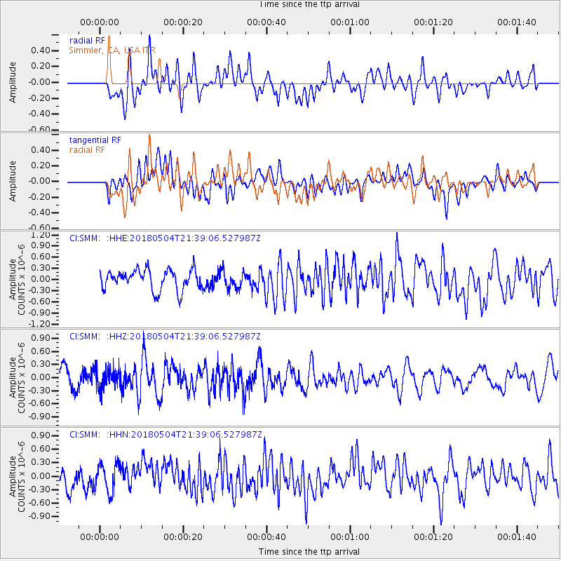
SMM Simmler, CA, USA - Earthquake Result Viewer
*The percent match for this event was below the threshold and hence no stack was calculated.
| Earthquake location: |
Hawaii |
| Earthquake latitude/longitude: |
19.3/-155.0 |
| Earthquake time(UTC): |
2018/05/04 (124) 21:32:44 GMT |
| Earthquake Depth: |
6.9 km |
| Earthquake Magnitude: |
5.7 Ml |
| Earthquake Catalog/Contributor: |
NEIC PDE/hv |
|
| Network: |
CI Caltech Regional Seismic Network |
| Station: |
SMM Simmler, CA, USA |
| Lat/Lon: |
35.31 N/120.00 W |
| Elevation: |
599 m |
|
| Distance: |
34.7 deg |
| Az: |
55.479 deg |
| Baz: |
252.044 deg |
| Ray Param: |
$rayparam |
*The percent match for this event was below the threshold and hence was not used in the summary stack. |
|
| Radial Match: |
52.69128 % |
| Radial Bump: |
400 |
| Transverse Match: |
42.697445 % |
| Transverse Bump: |
400 |
| SOD ConfigId: |
13570011 |
| Insert Time: |
2019-04-30 04:45:35.767 +0000 |
| GWidth: |
2.5 |
| Max Bumps: |
400 |
| Tol: |
0.001 |
|
Signal To Noise
| Channel | StoN | STA | LTA |
| CI:SMM: :HHZ:20180504T21:39:06.527987Z | 1.0577284 | 2.1084428E-7 | 1.9933687E-7 |
| CI:SMM: :HHN:20180504T21:39:06.527987Z | 1.6336386 | 3.1775178E-7 | 1.9450555E-7 |
| CI:SMM: :HHE:20180504T21:39:06.527987Z | 0.7423354 | 2.0552437E-7 | 2.7686187E-7 |
| Arrivals |
| Ps | |
| PpPs | |
| PsPs/PpSs | |


