You are here: Home > Network List > TA - USArray Transportable Network (new EarthScope stations) Stations List
> Station 123A Bell Site, White Sands Missle Range, NM, USA > Earthquake Result Viewer
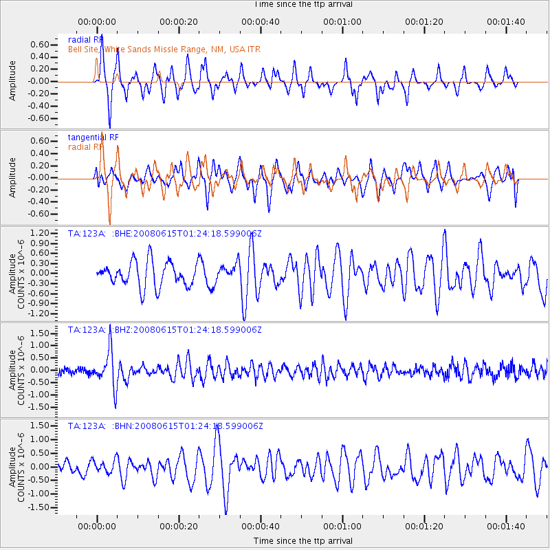
123A Bell Site, White Sands Missle Range, NM, USA - Earthquake Result Viewer
*The percent match for this event was below the threshold and hence no stack was calculated.
| Earthquake location: |
Fiji Islands Region |
| Earthquake latitude/longitude: |
-17.7/-179.7 |
| Earthquake time(UTC): |
2008/06/15 (167) 01:13:11 GMT |
| Earthquake Depth: |
611 km |
| Earthquake Magnitude: |
5.5 MB, 5.9 MW, 5.9 MW |
| Earthquake Catalog/Contributor: |
WHDF/NEIC |
|
| Network: |
TA USArray Transportable Network (new EarthScope stations) |
| Station: |
123A Bell Site, White Sands Missle Range, NM, USA |
| Lat/Lon: |
32.63 N/106.26 W |
| Elevation: |
1206 m |
|
| Distance: |
86.2 deg |
| Az: |
54.162 deg |
| Baz: |
246.305 deg |
| Ray Param: |
$rayparam |
*The percent match for this event was below the threshold and hence was not used in the summary stack. |
|
| Radial Match: |
61.46327 % |
| Radial Bump: |
273 |
| Transverse Match: |
48.348137 % |
| Transverse Bump: |
372 |
| SOD ConfigId: |
2504 |
| Insert Time: |
2010-03-06 10:51:47.508 +0000 |
| GWidth: |
2.5 |
| Max Bumps: |
400 |
| Tol: |
0.001 |
|
Signal To Noise
| Channel | StoN | STA | LTA |
| TA:123A: :BHZ:20080615T01:24:18.599006Z | 6.693329 | 7.639529E-7 | 1.1413647E-7 |
| TA:123A: :BHN:20080615T01:24:18.599006Z | 0.5735392 | 2.2715895E-7 | 3.9606525E-7 |
| TA:123A: :BHE:20080615T01:24:18.599006Z | 0.6881657 | 2.5190843E-7 | 3.6605783E-7 |
| Arrivals |
| Ps | |
| PpPs | |
| PsPs/PpSs | |


