You are here: Home > Network List > TA - USArray Transportable Network (new EarthScope stations) Stations List
> Station B18K Kokolik River, AK, USA > Earthquake Result Viewer
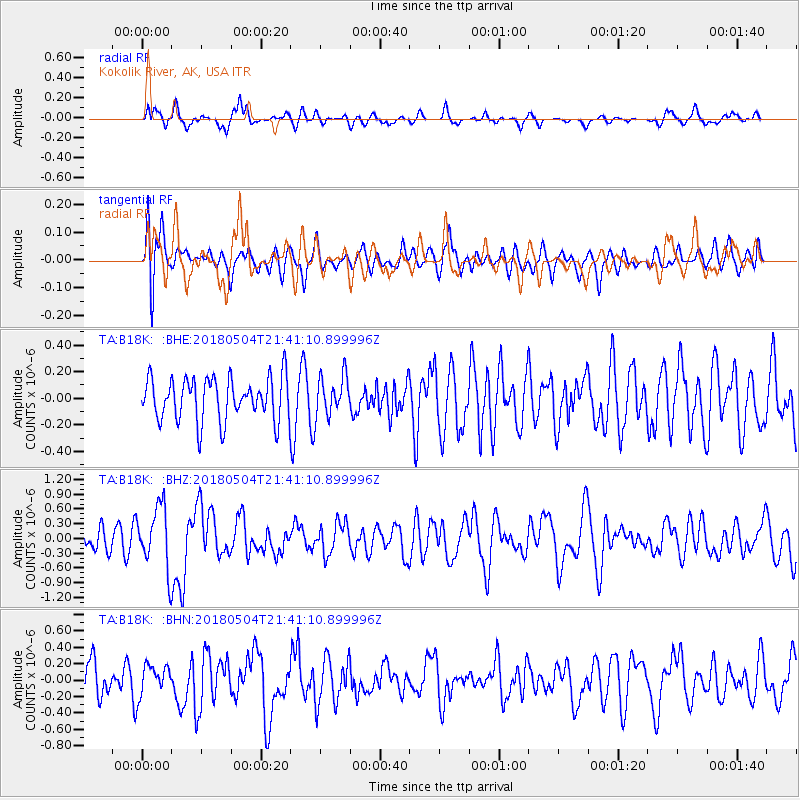
B18K Kokolik River, AK, USA - Earthquake Result Viewer
*The percent match for this event was below the threshold and hence no stack was calculated.
| Earthquake location: |
Hawaii |
| Earthquake latitude/longitude: |
19.3/-155.0 |
| Earthquake time(UTC): |
2018/05/04 (124) 21:32:44 GMT |
| Earthquake Depth: |
6.9 km |
| Earthquake Magnitude: |
5.7 Ml |
| Earthquake Catalog/Contributor: |
NEIC PDE/hv |
|
| Network: |
TA USArray Transportable Network (new EarthScope stations) |
| Station: |
B18K Kokolik River, AK, USA |
| Lat/Lon: |
69.36 N/161.80 W |
| Elevation: |
222 m |
|
| Distance: |
50.2 deg |
| Az: |
356.882 deg |
| Baz: |
171.669 deg |
| Ray Param: |
$rayparam |
*The percent match for this event was below the threshold and hence was not used in the summary stack. |
|
| Radial Match: |
59.322983 % |
| Radial Bump: |
400 |
| Transverse Match: |
56.35046 % |
| Transverse Bump: |
400 |
| SOD ConfigId: |
13570011 |
| Insert Time: |
2019-04-30 04:50:31.483 +0000 |
| GWidth: |
2.5 |
| Max Bumps: |
400 |
| Tol: |
0.001 |
|
Signal To Noise
| Channel | StoN | STA | LTA |
| TA:B18K: :BHZ:20180504T21:41:10.899996Z | 2.8489618 | 6.221676E-7 | 2.1838397E-7 |
| TA:B18K: :BHN:20180504T21:41:10.899996Z | 0.8956933 | 1.8702866E-7 | 2.0880883E-7 |
| TA:B18K: :BHE:20180504T21:41:10.899996Z | 1.0187534 | 1.5642028E-7 | 1.5354088E-7 |
| Arrivals |
| Ps | |
| PpPs | |
| PsPs/PpSs | |


