You are here: Home > Network List > TA - USArray Transportable Network (new EarthScope stations) Stations List
> Station BGNE Belgrade, NE, USA > Earthquake Result Viewer
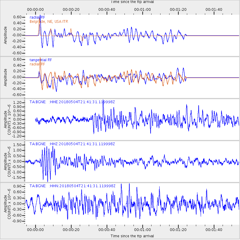
BGNE Belgrade, NE, USA - Earthquake Result Viewer
*The percent match for this event was below the threshold and hence no stack was calculated.
| Earthquake location: |
Hawaii |
| Earthquake latitude/longitude: |
19.3/-155.0 |
| Earthquake time(UTC): |
2018/05/04 (124) 21:32:44 GMT |
| Earthquake Depth: |
6.9 km |
| Earthquake Magnitude: |
5.7 Ml |
| Earthquake Catalog/Contributor: |
NEIC PDE/hv |
|
| Network: |
TA USArray Transportable Network (new EarthScope stations) |
| Station: |
BGNE Belgrade, NE, USA |
| Lat/Lon: |
41.41 N/98.15 W |
| Elevation: |
573 m |
|
| Distance: |
52.8 deg |
| Az: |
52.303 deg |
| Baz: |
263.344 deg |
| Ray Param: |
$rayparam |
*The percent match for this event was below the threshold and hence was not used in the summary stack. |
|
| Radial Match: |
70.544334 % |
| Radial Bump: |
400 |
| Transverse Match: |
67.94608 % |
| Transverse Bump: |
400 |
| SOD ConfigId: |
13570011 |
| Insert Time: |
2019-04-30 04:50:33.278 +0000 |
| GWidth: |
2.5 |
| Max Bumps: |
400 |
| Tol: |
0.001 |
|
Signal To Noise
| Channel | StoN | STA | LTA |
| TA:BGNE: :HHZ:20180504T21:41:31.119998Z | 5.829156 | 4.5710868E-7 | 7.841765E-8 |
| TA:BGNE: :HHN:20180504T21:41:31.119998Z | 2.2354937 | 3.1102533E-7 | 1.3913049E-7 |
| TA:BGNE: :HHE:20180504T21:41:31.119998Z | 1.539894 | 1.9749103E-7 | 1.2824975E-7 |
| Arrivals |
| Ps | |
| PpPs | |
| PsPs/PpSs | |


