You are here: Home > Network List > TA - USArray Transportable Network (new EarthScope stations) Stations List
> Station F20K Avaraart Lake, AK, USA > Earthquake Result Viewer
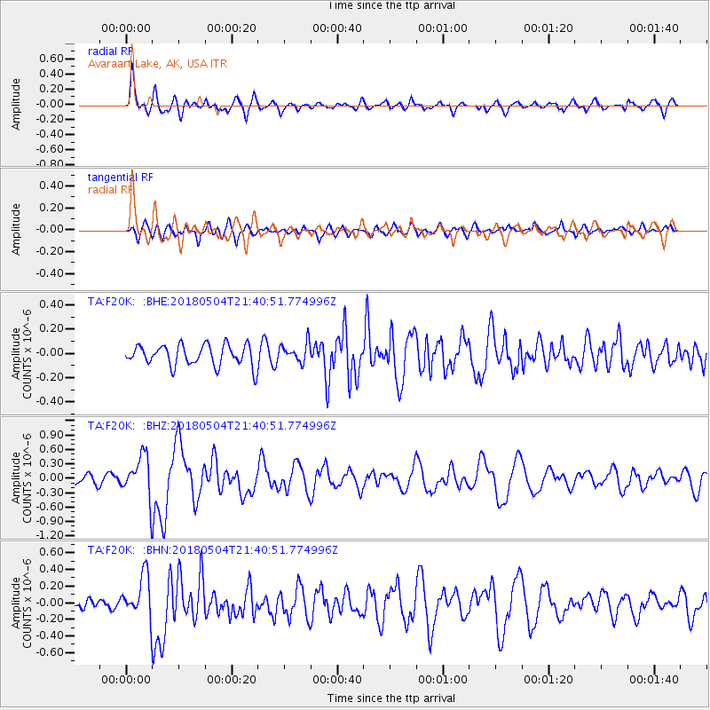
F20K Avaraart Lake, AK, USA - Earthquake Result Viewer
*The percent match for this event was below the threshold and hence no stack was calculated.
| Earthquake location: |
Hawaii |
| Earthquake latitude/longitude: |
19.3/-155.0 |
| Earthquake time(UTC): |
2018/05/04 (124) 21:32:44 GMT |
| Earthquake Depth: |
6.9 km |
| Earthquake Magnitude: |
5.7 Ml |
| Earthquake Catalog/Contributor: |
NEIC PDE/hv |
|
| Network: |
TA USArray Transportable Network (new EarthScope stations) |
| Station: |
F20K Avaraart Lake, AK, USA |
| Lat/Lon: |
67.05 N/155.73 W |
| Elevation: |
136 m |
|
| Distance: |
47.7 deg |
| Az: |
359.632 deg |
| Baz: |
179.115 deg |
| Ray Param: |
$rayparam |
*The percent match for this event was below the threshold and hence was not used in the summary stack. |
|
| Radial Match: |
75.424225 % |
| Radial Bump: |
400 |
| Transverse Match: |
51.829758 % |
| Transverse Bump: |
400 |
| SOD ConfigId: |
13570011 |
| Insert Time: |
2019-04-30 04:51:02.114 +0000 |
| GWidth: |
2.5 |
| Max Bumps: |
400 |
| Tol: |
0.001 |
|
Signal To Noise
| Channel | StoN | STA | LTA |
| TA:F20K: :BHZ:20180504T21:40:51.774996Z | 5.134394 | 4.273925E-7 | 8.3241076E-8 |
| TA:F20K: :BHN:20180504T21:40:51.774996Z | 2.879378 | 2.5184303E-7 | 8.746439E-8 |
| TA:F20K: :BHE:20180504T21:40:51.774996Z | 0.8836743 | 6.806599E-8 | 7.70261E-8 |
| Arrivals |
| Ps | |
| PpPs | |
| PsPs/PpSs | |


