You are here: Home > Network List > TA - USArray Transportable Network (new EarthScope stations) Stations List
> Station G16K Koyuk River, AK, USA > Earthquake Result Viewer
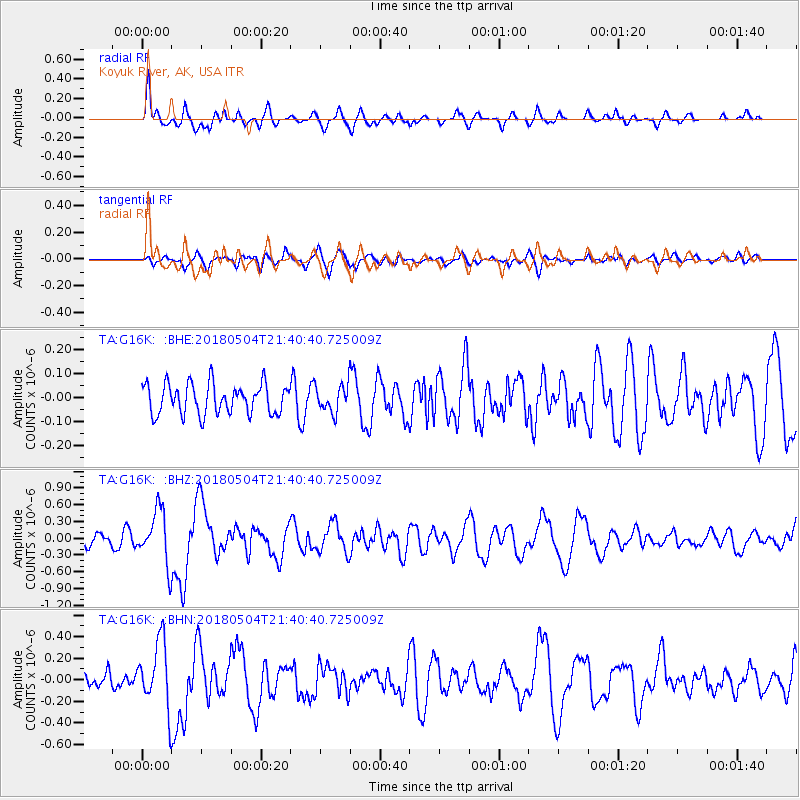
G16K Koyuk River, AK, USA - Earthquake Result Viewer
*The percent match for this event was below the threshold and hence no stack was calculated.
| Earthquake location: |
Hawaii |
| Earthquake latitude/longitude: |
19.3/-155.0 |
| Earthquake time(UTC): |
2018/05/04 (124) 21:32:44 GMT |
| Earthquake Depth: |
6.9 km |
| Earthquake Magnitude: |
5.7 Ml |
| Earthquake Catalog/Contributor: |
NEIC PDE/hv |
|
| Network: |
TA USArray Transportable Network (new EarthScope stations) |
| Station: |
G16K Koyuk River, AK, USA |
| Lat/Lon: |
65.39 N/162.35 W |
| Elevation: |
169 m |
|
| Distance: |
46.3 deg |
| Az: |
355.766 deg |
| Baz: |
170.414 deg |
| Ray Param: |
$rayparam |
*The percent match for this event was below the threshold and hence was not used in the summary stack. |
|
| Radial Match: |
77.46236 % |
| Radial Bump: |
400 |
| Transverse Match: |
61.157314 % |
| Transverse Bump: |
400 |
| SOD ConfigId: |
13570011 |
| Insert Time: |
2019-04-30 04:51:09.684 +0000 |
| GWidth: |
2.5 |
| Max Bumps: |
400 |
| Tol: |
0.001 |
|
Signal To Noise
| Channel | StoN | STA | LTA |
| TA:G16K: :BHZ:20180504T21:40:40.725009Z | 3.7667615 | 4.6780409E-7 | 1.2419264E-7 |
| TA:G16K: :BHN:20180504T21:40:40.725009Z | 2.38708 | 2.9925994E-7 | 1.2536653E-7 |
| TA:G16K: :BHE:20180504T21:40:40.725009Z | 0.84660673 | 5.3630615E-8 | 6.3347734E-8 |
| Arrivals |
| Ps | |
| PpPs | |
| PsPs/PpSs | |


