You are here: Home > Network List > TA - USArray Transportable Network (new EarthScope stations) Stations List
> Station H31M Peel River, Yukon, CAN > Earthquake Result Viewer
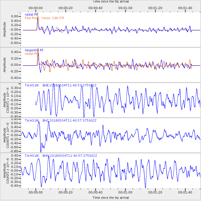
H31M Peel River, Yukon, CAN - Earthquake Result Viewer
*The percent match for this event was below the threshold and hence no stack was calculated.
| Earthquake location: |
Hawaii |
| Earthquake latitude/longitude: |
19.3/-155.0 |
| Earthquake time(UTC): |
2018/05/04 (124) 21:32:44 GMT |
| Earthquake Depth: |
6.9 km |
| Earthquake Magnitude: |
5.7 Ml |
| Earthquake Catalog/Contributor: |
NEIC PDE/hv |
|
| Network: |
TA USArray Transportable Network (new EarthScope stations) |
| Station: |
H31M Peel River, Yukon, CAN |
| Lat/Lon: |
65.81 N/134.34 W |
| Elevation: |
642 m |
|
| Distance: |
48.4 deg |
| Az: |
11.229 deg |
| Baz: |
206.498 deg |
| Ray Param: |
$rayparam |
*The percent match for this event was below the threshold and hence was not used in the summary stack. |
|
| Radial Match: |
65.70686 % |
| Radial Bump: |
400 |
| Transverse Match: |
51.521187 % |
| Transverse Bump: |
400 |
| SOD ConfigId: |
13570011 |
| Insert Time: |
2019-04-30 04:51:31.289 +0000 |
| GWidth: |
2.5 |
| Max Bumps: |
400 |
| Tol: |
0.001 |
|
Signal To Noise
| Channel | StoN | STA | LTA |
| TA:H31M: :BHZ:20180504T21:40:57.375002Z | 2.9693105 | 4.4377254E-7 | 1.4945306E-7 |
| TA:H31M: :BHN:20180504T21:40:57.375002Z | 1.8809468 | 2.5108852E-7 | 1.334905E-7 |
| TA:H31M: :BHE:20180504T21:40:57.375002Z | 1.1201645 | 2.1564718E-7 | 1.9251384E-7 |
| Arrivals |
| Ps | |
| PpPs | |
| PsPs/PpSs | |


