You are here: Home > Network List > TA - USArray Transportable Network (new EarthScope stations) Stations List
> Station I30M Mount Dempster, Yukon, CAN > Earthquake Result Viewer
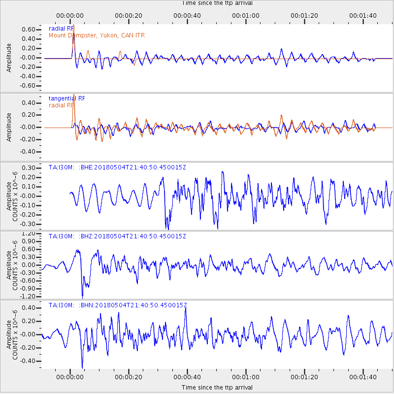
I30M Mount Dempster, Yukon, CAN - Earthquake Result Viewer
*The percent match for this event was below the threshold and hence no stack was calculated.
| Earthquake location: |
Hawaii |
| Earthquake latitude/longitude: |
19.3/-155.0 |
| Earthquake time(UTC): |
2018/05/04 (124) 21:32:44 GMT |
| Earthquake Depth: |
6.9 km |
| Earthquake Magnitude: |
5.7 Ml |
| Earthquake Catalog/Contributor: |
NEIC PDE/hv |
|
| Network: |
TA USArray Transportable Network (new EarthScope stations) |
| Station: |
I30M Mount Dempster, Yukon, CAN |
| Lat/Lon: |
65.22 N/136.38 W |
| Elevation: |
1399 m |
|
| Distance: |
47.5 deg |
| Az: |
10.535 deg |
| Baz: |
204.184 deg |
| Ray Param: |
$rayparam |
*The percent match for this event was below the threshold and hence was not used in the summary stack. |
|
| Radial Match: |
74.30569 % |
| Radial Bump: |
400 |
| Transverse Match: |
67.07967 % |
| Transverse Bump: |
400 |
| SOD ConfigId: |
13570011 |
| Insert Time: |
2019-04-30 04:51:37.351 +0000 |
| GWidth: |
2.5 |
| Max Bumps: |
400 |
| Tol: |
0.001 |
|
Signal To Noise
| Channel | StoN | STA | LTA |
| TA:I30M: :BHZ:20180504T21:40:50.450015Z | 7.450589 | 4.7015175E-7 | 6.3102625E-8 |
| TA:I30M: :BHN:20180504T21:40:50.450015Z | 1.5231919 | 1.7902525E-7 | 1.1753296E-7 |
| TA:I30M: :BHE:20180504T21:40:50.450015Z | 1.8278099 | 1.3983201E-7 | 7.650249E-8 |
| Arrivals |
| Ps | |
| PpPs | |
| PsPs/PpSs | |


