You are here: Home > Network List > TA - USArray Transportable Network (new EarthScope stations) Stations List
> Station J26L Joseph Creek, AK, USA > Earthquake Result Viewer
J26L Joseph Creek, AK, USA - Earthquake Result Viewer
*The percent match for this event was below the threshold and hence no stack was calculated.
| Earthquake location: |
Hawaii |
| Earthquake latitude/longitude: |
19.3/-155.0 |
| Earthquake time(UTC): |
2018/05/04 (124) 21:32:44 GMT |
| Earthquake Depth: |
6.9 km |
| Earthquake Magnitude: |
5.7 Ml |
| Earthquake Catalog/Contributor: |
NEIC PDE/hv |
|
| Network: |
TA USArray Transportable Network (new EarthScope stations) |
| Station: |
J26L Joseph Creek, AK, USA |
| Lat/Lon: |
64.50 N/143.56 W |
| Elevation: |
1144 m |
|
| Distance: |
45.8 deg |
| Az: |
6.897 deg |
| Baz: |
195.185 deg |
| Ray Param: |
$rayparam |
*The percent match for this event was below the threshold and hence was not used in the summary stack. |
|
| Radial Match: |
84.31594 % |
| Radial Bump: |
400 |
| Transverse Match: |
54.308372 % |
| Transverse Bump: |
400 |
| SOD ConfigId: |
13570011 |
| Insert Time: |
2019-04-30 04:51:43.447 +0000 |
| GWidth: |
2.5 |
| Max Bumps: |
400 |
| Tol: |
0.001 |
|
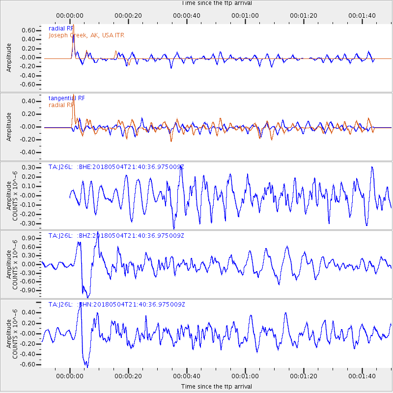
Signal To Noise
| Channel | StoN | STA | LTA |
| TA:J26L: :BHZ:20180504T21:40:36.975009Z | 5.6584654 | 4.827878E-7 | 8.5321325E-8 |
| TA:J26L: :BHN:20180504T21:40:36.975009Z | 3.5478456 | 2.9088594E-7 | 8.1989455E-8 |
| TA:J26L: :BHE:20180504T21:40:36.975009Z | 0.7291295 | 7.939464E-8 | 1.0888962E-7 |
| Arrivals |
| Ps | |
| PpPs | |
| PsPs/PpSs | |


