You are here: Home > Network List > TA - USArray Transportable Network (new EarthScope stations) Stations List
> Station R33M Jennings River, BC, CAN > Earthquake Result Viewer
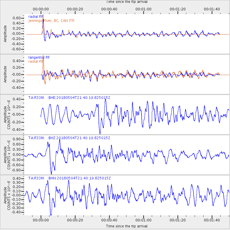
R33M Jennings River, BC, CAN - Earthquake Result Viewer
*The percent match for this event was below the threshold and hence no stack was calculated.
| Earthquake location: |
Hawaii |
| Earthquake latitude/longitude: |
19.3/-155.0 |
| Earthquake time(UTC): |
2018/05/04 (124) 21:32:44 GMT |
| Earthquake Depth: |
6.9 km |
| Earthquake Magnitude: |
5.7 Ml |
| Earthquake Catalog/Contributor: |
NEIC PDE/hv |
|
| Network: |
TA USArray Transportable Network (new EarthScope stations) |
| Station: |
R33M Jennings River, BC, CAN |
| Lat/Lon: |
59.39 N/130.97 W |
| Elevation: |
1437 m |
|
| Distance: |
43.6 deg |
| Az: |
17.606 deg |
| Baz: |
213.931 deg |
| Ray Param: |
$rayparam |
*The percent match for this event was below the threshold and hence was not used in the summary stack. |
|
| Radial Match: |
66.40896 % |
| Radial Bump: |
400 |
| Transverse Match: |
63.524593 % |
| Transverse Bump: |
400 |
| SOD ConfigId: |
13570011 |
| Insert Time: |
2019-04-30 04:52:30.683 +0000 |
| GWidth: |
2.5 |
| Max Bumps: |
400 |
| Tol: |
0.001 |
|
Signal To Noise
| Channel | StoN | STA | LTA |
| TA:R33M: :BHZ:20180504T21:40:19.825015Z | 3.420677 | 2.9659773E-7 | 8.6707324E-8 |
| TA:R33M: :BHN:20180504T21:40:19.825015Z | 1.9436439 | 1.76508E-7 | 9.0812925E-8 |
| TA:R33M: :BHE:20180504T21:40:19.825015Z | 0.8577283 | 1.2471315E-7 | 1.4539937E-7 |
| Arrivals |
| Ps | |
| PpPs | |
| PsPs/PpSs | |


