You are here: Home > Network List > IU - Global Seismograph Network (GSN - IRIS/USGS) Stations List
> Station CTAO Charters Towers, Australia > Earthquake Result Viewer
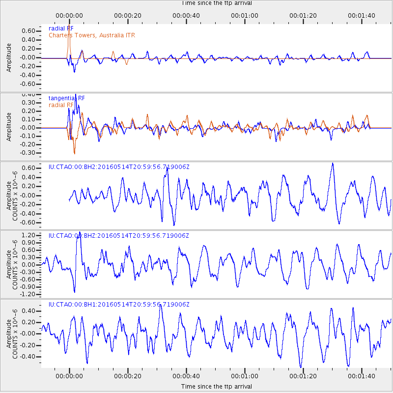
CTAO Charters Towers, Australia - Earthquake Result Viewer
*The percent match for this event was below the threshold and hence no stack was calculated.
| Earthquake location: |
Southwest Of Sumatra, Indonesia |
| Earthquake latitude/longitude: |
-6.9/101.8 |
| Earthquake time(UTC): |
2016/05/14 (135) 20:52:11 GMT |
| Earthquake Depth: |
10 km |
| Earthquake Magnitude: |
5.6 MB, 5.3 MWW |
| Earthquake Catalog/Contributor: |
NEIC PDE/NEIC COMCAT |
|
| Network: |
IU Global Seismograph Network (GSN - IRIS/USGS) |
| Station: |
CTAO Charters Towers, Australia |
| Lat/Lon: |
20.09 S/146.25 E |
| Elevation: |
357 m |
|
| Distance: |
45.0 deg |
| Az: |
111.497 deg |
| Baz: |
280.608 deg |
| Ray Param: |
$rayparam |
*The percent match for this event was below the threshold and hence was not used in the summary stack. |
|
| Radial Match: |
68.956635 % |
| Radial Bump: |
400 |
| Transverse Match: |
77.39573 % |
| Transverse Bump: |
400 |
| SOD ConfigId: |
1475611 |
| Insert Time: |
2016-05-28 20:54:15.665 +0000 |
| GWidth: |
2.5 |
| Max Bumps: |
400 |
| Tol: |
0.001 |
|
Signal To Noise
| Channel | StoN | STA | LTA |
| IU:CTAO:00:BHZ:20160514T20:59:56.719006Z | 3.0013509 | 7.1363434E-7 | 2.3777105E-7 |
| IU:CTAO:00:BH1:20160514T20:59:56.719006Z | 1.1079037 | 1.9200226E-7 | 1.7330231E-7 |
| IU:CTAO:00:BH2:20160514T20:59:56.719006Z | 2.2781575 | 3.1851562E-7 | 1.3981283E-7 |
| Arrivals |
| Ps | |
| PpPs | |
| PsPs/PpSs | |


