You are here: Home > Network List > UW - Pacific Northwest Regional Seismic Network Stations List
> Station UMAT Pilot Rock, OR, USA > Earthquake Result Viewer
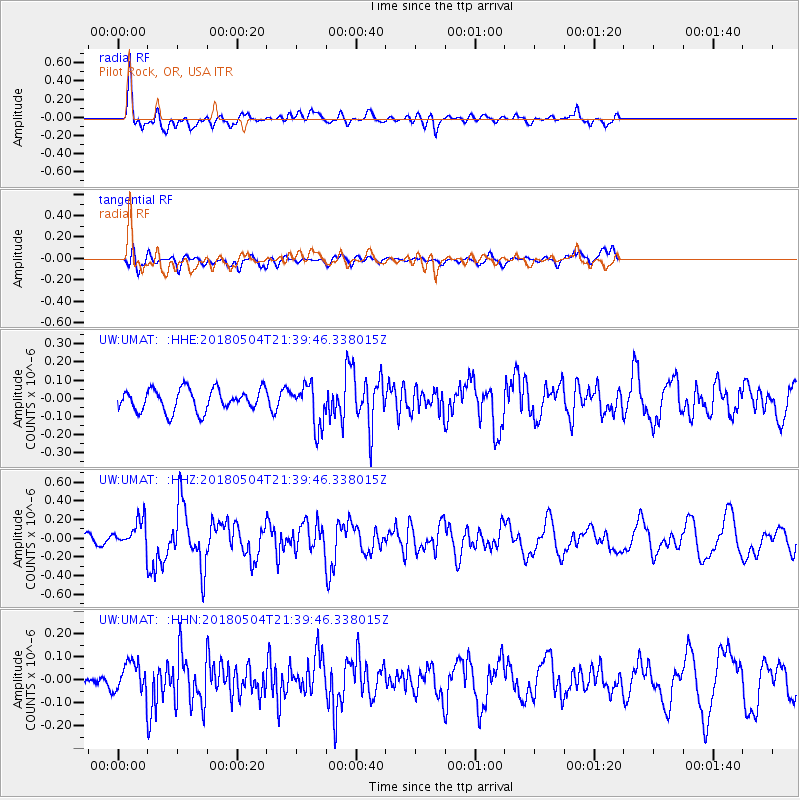
UMAT Pilot Rock, OR, USA - Earthquake Result Viewer
*The percent match for this event was below the threshold and hence no stack was calculated.
| Earthquake location: |
Hawaii |
| Earthquake latitude/longitude: |
19.3/-155.0 |
| Earthquake time(UTC): |
2018/05/04 (124) 21:32:44 GMT |
| Earthquake Depth: |
6.9 km |
| Earthquake Magnitude: |
5.7 Ml |
| Earthquake Catalog/Contributor: |
NEIC PDE/hv |
|
| Network: |
UW Pacific Northwest Regional Seismic Network |
| Station: |
UMAT Pilot Rock, OR, USA |
| Lat/Lon: |
45.29 N/118.96 W |
| Elevation: |
1318 m |
|
| Distance: |
39.5 deg |
| Az: |
40.832 deg |
| Baz: |
240.999 deg |
| Ray Param: |
$rayparam |
*The percent match for this event was below the threshold and hence was not used in the summary stack. |
|
| Radial Match: |
74.98589 % |
| Radial Bump: |
400 |
| Transverse Match: |
59.314476 % |
| Transverse Bump: |
400 |
| SOD ConfigId: |
13570011 |
| Insert Time: |
2019-04-30 04:53:54.620 +0000 |
| GWidth: |
2.5 |
| Max Bumps: |
400 |
| Tol: |
0.001 |
|
Signal To Noise
| Channel | StoN | STA | LTA |
| UW:UMAT: :HHZ:20180504T21:39:46.338015Z | 3.1765032 | 1.5247042E-7 | 4.7999453E-8 |
| UW:UMAT: :HHN:20180504T21:39:46.338015Z | 1.421013 | 6.688434E-8 | 4.706807E-8 |
| UW:UMAT: :HHE:20180504T21:39:46.338015Z | 1.1074545 | 6.6020085E-8 | 5.9614266E-8 |
| Arrivals |
| Ps | |
| PpPs | |
| PsPs/PpSs | |


