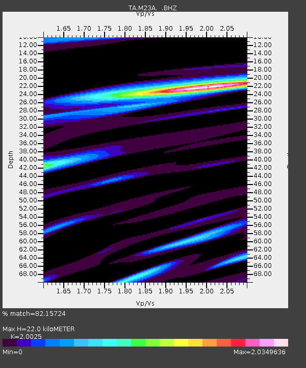
M23A Laramie, WY, USA - Earthquake Result Viewer
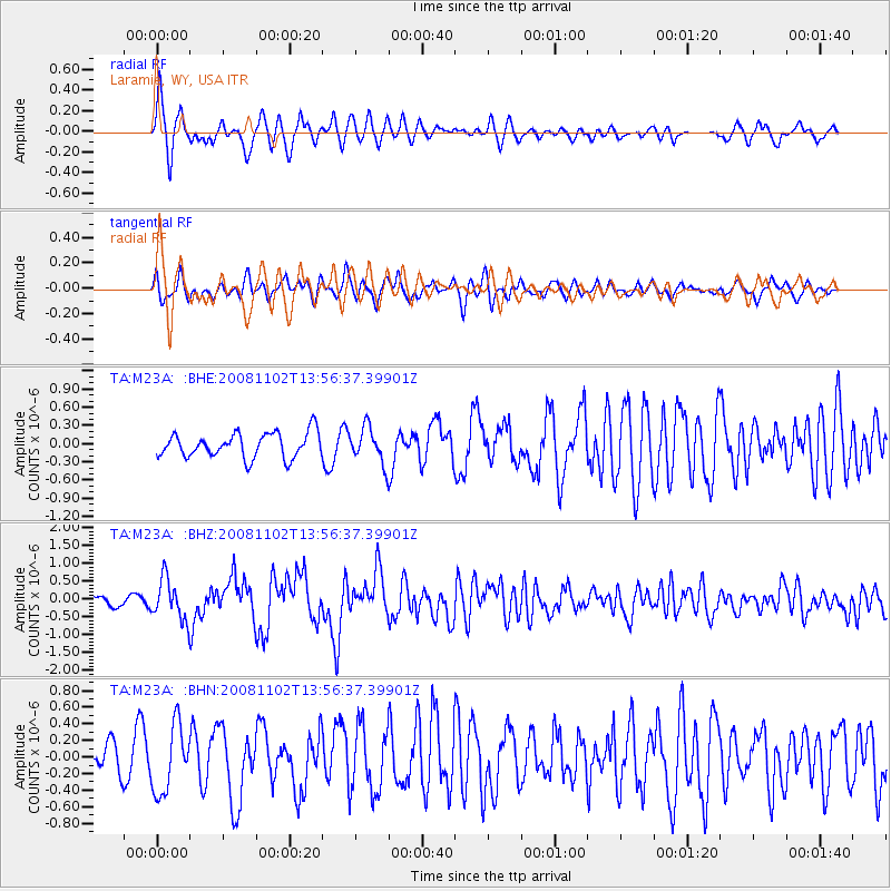
Earthquake location: Andreanof Islands, Aleutian Is.
Earthquake latitude/longitude: 51.6/-174.4
Earthquake time(UTC): 2008/11/02 (307) 13:48:42 GMT
Earthquake Depth: 36 km
Earthquake Magnitude: 5.7 MB, 5.8 MS, 6.1 MW, 6.1 MW
Earthquake Catalog/Contributor: WHDF/NEIC
Network: TA USArray Transportable Network (new EarthScope stations)
Station: M23A Laramie, WY, USA
Lat/Lon: 41.47 N/105.72 W
Elevation: 2166 m
Distance: 46.7 deg
Az: 74.196 deg
Baz: 306.928 deg
Ray Param: 0.07042312
Estimated Moho Depth: 22.0 km
Estimated Crust Vp/Vs: 2.00
Assumed Crust Vp: 6.306 km/s
Estimated Crust Vs: 3.149 km/s
Estimated Crust Poisson's Ratio: 0.33
Radial Match: 82.15724 %
Radial Bump: 364
Transverse Match: 52.348995 %
Transverse Bump: 400
SOD ConfigId: 2658
Insert Time: 2010-03-06 10:53:14.497 +0000
GWidth: 2.5
Max Bumps: 400
Tol: 0.001

Signal To Noise

ChannelStoNSTALTA
TA:M23A: :BHZ:20081102T13:56:37.39901Z3.71053965.61746E-71.5139199E-7
TA:M23A: :BHN:20081102T13:56:37.39901Z1.87392454.0821945E-72.17842E-7
TA:M23A: :BHE:20081102T13:56:37.39901Z1.43208042.924572E-72.0421842E-7
Arrivals
Ps3.7 SECOND
PpPs9.9 SECOND
PsPs/PpSs14 SECOND