You are here: Home > Network List > TA - USArray Transportable Network (new EarthScope stations) Stations List
> Station M23A Laramie, WY, USA > Earthquake Result Viewer
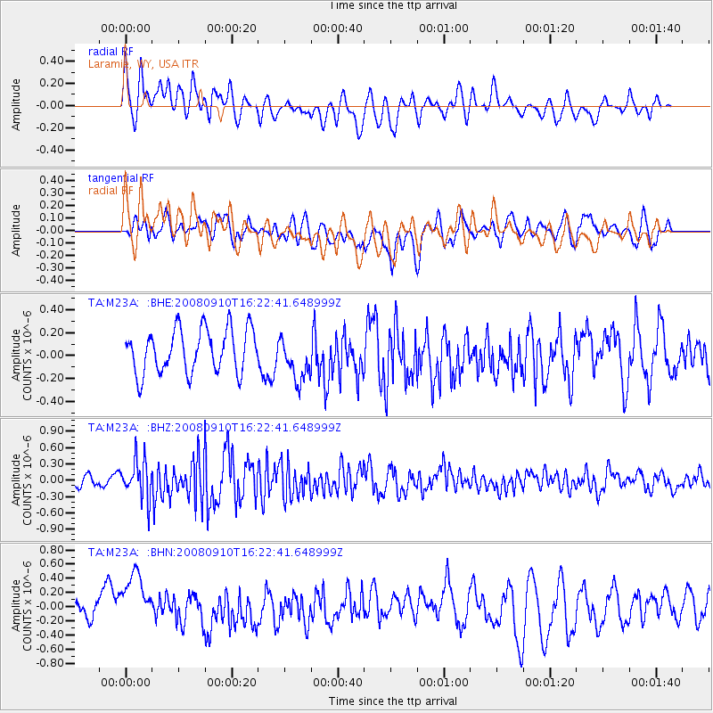
M23A Laramie, WY, USA - Earthquake Result Viewer
*The percent match for this event was below the threshold and hence no stack was calculated.
| Earthquake location: |
Northern Chile |
| Earthquake latitude/longitude: |
-20.3/-69.2 |
| Earthquake time(UTC): |
2008/09/10 (254) 16:12:04 GMT |
| Earthquake Depth: |
38 km |
| Earthquake Magnitude: |
5.6 MB, 5.3 MS |
| Earthquake Catalog/Contributor: |
WHDF/NEIC |
|
| Network: |
TA USArray Transportable Network (new EarthScope stations) |
| Station: |
M23A Laramie, WY, USA |
| Lat/Lon: |
41.47 N/105.72 W |
| Elevation: |
2166 m |
|
| Distance: |
70.1 deg |
| Az: |
331.619 deg |
| Baz: |
143.571 deg |
| Ray Param: |
$rayparam |
*The percent match for this event was below the threshold and hence was not used in the summary stack. |
|
| Radial Match: |
43.304012 % |
| Radial Bump: |
400 |
| Transverse Match: |
56.138313 % |
| Transverse Bump: |
400 |
| SOD ConfigId: |
2560 |
| Insert Time: |
2010-03-06 10:54:51.444 +0000 |
| GWidth: |
2.5 |
| Max Bumps: |
400 |
| Tol: |
0.001 |
|
Signal To Noise
| Channel | StoN | STA | LTA |
| TA:M23A: :BHZ:20080910T16:22:41.648999Z | 3.9096482 | 3.532074E-7 | 9.034251E-8 |
| TA:M23A: :BHN:20080910T16:22:41.648999Z | 3.0692644 | 4.2250105E-7 | 1.3765548E-7 |
| TA:M23A: :BHE:20080910T16:22:41.648999Z | 1.0471786 | 1.9858565E-7 | 1.8963875E-7 |
| Arrivals |
| Ps | |
| PpPs | |
| PsPs/PpSs | |


